|

East Weares Rifle Range and Waterworks
Page and some links last revised/updated 23rd April 2025.
A huge disused ex-Royal Naval rifle range is located at [1]. This is within the security fence of Portland Port and not open to the public. However, I managed to get into this area before the security gates were installed and photographed the inner workings of the range.
At the point indicated as [2] there was, in Victorian times, a waterworks building with reservoirs. Originally this provided water to the prison but, after several prisoners died of Typhoid, an unsuccessful search on the Island for fresh water was abandoned and the waterworks at Friar Waddon near Upwey were opened.
At [3] is Folly Pier which, like King’s Pier nearby was much used to export stone. This pier has survived in a better condition than King’s Pier.
At [4] is a derelict World War 2 pillbox.
The area of the Youth Offenders Institute at [5] is now a secure exercise area and was once a housing estate for prison staff.
At [6] were, until recently, buildings used for the storage of munition for the nearby HMS OSPREY. The buildings were mostly ‘red brick World War 2’ architectural style. Functional and boring.
A derelict Range Lookout Post survives [7] at the rear of the Youth Offenders Institute (YOI).
Curving from top to bottom of the aerial picture is the abandoned mainline railway track between Weymouth and Portland.
Please click here for a detailed map. Click the BACK button on your browser to return to this page.
Please click here to visit the satellite image of this area on Google Maps. Click the BACK button on your browser to return to this page.
|
Please use this table to navigate around this page
|
|
DISUSED RIFLE RANGE [1]
|

|
|
VICTORIAN WATERWORKS [2]
|

|
|
FOLLY PIER [3]
|

|
|
WORLD WAR 2 PILLBOX [4]
|

|
|
PRISON STAFF HOUSES [5]
|

|
|
MUNITIONS STORAGE BUILDINGS [6]
|

|
|
RANGE LOOKOUT BUILDING [7]
|

|
|
DISUSED EAST WEARES RIFLE RANGE [1]
The history of the abandoned East Weares Rifle Range is described in Ashley Smith’s website which can be read here. The following is abstracted from Ashley’s research.
The East Weares Rifle Range was built between 1889 and 1903 and was closed down in the 1980s after a member of the public was killed by a stray bullet on a firing range in Hampshire. This led to a review of all such facilities and the East Weares Rifle Range was considered too dangerous to use.
The East Weares area has been labelled a Site of Special Scientific Interest (SSSI), largely due to the scrub and wildlife being of high nature conservation value.
It was decided in 2007 to release ten British Primitive goats into the area to control the scrub, and these are still kept in the area today and can often be spotted from the footpath to the east of the Youth Offenders Institute (YOI) on the top of the cliff. These goats are all males to prevent breeding.
The massive ‘Stop Butt’ for the bullets is to the right of this picture. In the centre is the building and mechanisms for raising and lowering the targets.
The Rifle Range now lies wholly within the property of Portland Port and is inaccessible. However, until a few years ago the security gate to the site would sometimes be found open and it was then possible to wander around the site.
It was on such a sortie in 2004 that I secured the pictures that follow.
This shows the target mechanism returning to nature as the brambles and shrubs overwhelm the ironwork.
Nearby are some remains of the support equipment and buildings that provided communications and security at the site.
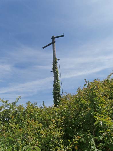
A telephone post still stands as the undergrowth inexorably winds its way up to the top. A similar fate awaits another pole nearby.
A sentry box stands isolated above the public footpath that now runs along the old abandoned railway track.
Trains had to stop when firing was in progress and ramblers were also stopped. However, there was some compromise with the railway because the firing was usually arranged to fit in with the train timetable to avoid accidentally shooting passengers.
A Victorian plastic B&Q garden seat made in China as used by the sentries of long ago? Probably not...
This raised the question during my visit “Who would be bothered to carry two old seats all the way down from the path from the cliff edge to put it in the sentry box?” Someone with enormous energy, spare time and an urge to relax in a brick hut far from civilisation.
As a revenge for the infamous 1803 ‘Portland Massacre’ when several Portlanders were brutally murdered by a Press Gang led by the Mayor of Weymouth, all Portland’s sewerage is now collected at Southwell (click here for details) and sent in this huge pipe more-or-less along the path of the old railway track to Wyke Regis where it is purified and pumped out to sea.
Some wag has painted these bunnies on the concrete plinth of the sewer pipe. Graffiti of these ‘underground mutton’ have appeared all over Portland in recent years.
Return To Top Of Page
VICTORIAN WATERWORKS [2]
If you walk on the South-West Coastal Path where it passes behind the YOI and look down over East Weares you will not imagine that there was once a substantial waterworks on the land below between the old railway line and the sea.
Look carefully and you will make out rectangular reservoirs which once stored the water to supply the Victorian Grove Prison.
A detailed history of these waterworks can be read here.
All that is now left are these overgrown open tanks where goats roam eating the scrub that continually encroaches on the site as seen in the picture below.
The above picture from 2003 shows the site heavily overgrown. Beneath this tangle of brambles lie a few low broken stone foundations and walls. In 1989 my children helped me, with the add of shears and knives, to cut away enough of the brambles to be able to trace the foundations of the main building.
Very few Portlanders know what these smothered ruins once were. This waterworks was closed due to an outbreak of typhoid which killed several prisoners who drank the water. All that now remains are the foundations of the building which are wholly overgrown and a few of the reservoirs.
Attempts were made to locate pure sources of water on Portland but every attempt failed. Above we see a test shaft being sunk at Southwell outside the site of Southwell Primary School. This went down 200 feet and then shafts were cut horizontally out to as far as 170 feet in the search for clean drinking water.
Sadly, the water in this shaft was contaminated by seawater and sewerage so the whole complex was sealed off and forgotten.
Early in the 20th century a new waterworks was built at Friar Warren in Upwey on the mainline - as seen above - to supply Portland’s water.
In 1921 the Grove Prison was converted into a Borstal and the waterworks had been destroyed. However during the late 1920s and 1930s, the ruins of the reservoir tanks were used as swimming pools for Borstal Boys, despite the risk of Typhoid.
The above picture taken in 1927 shows one of the annual Borstal swimming gala.
In 1933, one of the boys drowned and swimming no longer took place in the reservoirs.
This picture from 1990 shows the derelict state of the reservoirs.
This picture from 1992 show some of my more adventurous friends in one of the reservoirs. I had not told them about the risk of Typhoid!
One of the reservoirs holds water and a large population of frogs breeds there every Spring amongst the reeds.
Return To Top Of Page
FOLLY PIER [3]
The history of Folly Pier can be read here. It was originally built in the late 1600s but by 1745 it had been abandoned due to its inaccessibility to the main quarries and being awkward to use from the sea. A new pier was built but, with the opening of inland quarries and the building of the Merchants Railway in the 1820s Folly pier was abandoned to decay to the state it is now in.
My picture from the early 1990s shows it to be still substantially intact on the seaward face.
Return To Top Of Page
WORLD WAR 2 PILLBOX [4]
A short distance north of Folly Pier is a World War 2 pillbox. Built in the early days of the war it has now on the edge of a crumbling soft Kimmeridge Clay cliff as shown above.
I have climbed up this difficult cliff to explore the building whose history is described here.
Climbing this crumbling cliff is intimidating because the pillbox is overhanging the edge and looks as though it might fall on me.
The inside of the pillbox is relatively clean although there is some sign of parties having been held here. Why would people go to all the trouble of getting to Folly Pier, scrambling up a dangerously crumbling cliff and forcing their way through brambles to get to the entrance - whilst carrying cases of canned drinks?
Return To Top Of Page
PRISON STAFF HOUSES [5]
The area behind this security wall on the east side of the YOI used to be an estate of houses used by staff in the days of the Grove Prison. The next two pictures show what life was like before the estate was demolished due to the houses being decayed and uninhabitable.
In the above picture prisoners are transporting goods in carts through the estate.
Return To Top Of Page
MUNITIONS STORAGE BUILDING [6]
At point [6] on the map at the top of this page were some post-World War 2 buildings which were used to store armaments that were flown on the Royal Naval Air Station helicopters. I was able to get into this site and entered several of the buildings in around 2005 before the site was made secure. Unfortunately, I thought there was little of interest to photograph so have no record of my visit.
Return To Top Of Page
RANGE LOOKOUT BUILDING [7]
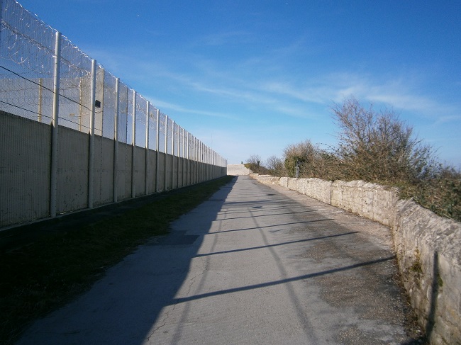
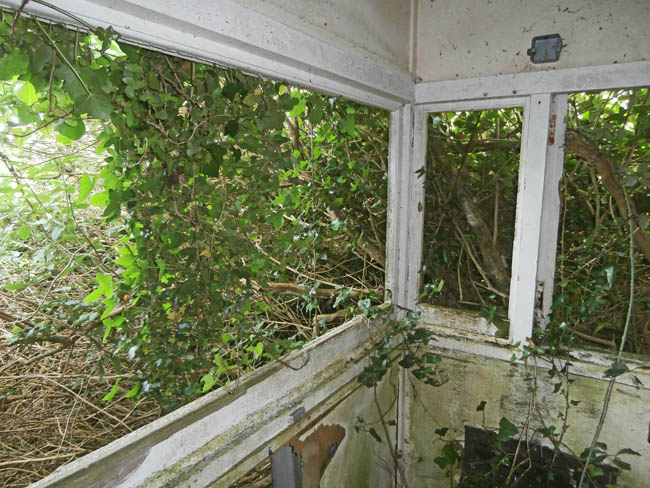
This view shows the eastern boundary of the Youth Offenders Institute (YOI). On the right is a sheer cliff which goes down to West Weares and the sea. In the middle distance is a derelict Range Observation Post which is well camouflaged by brambles as shown below.
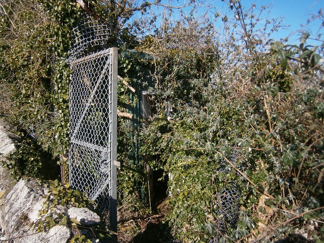
Being an intrepid explorer of such places I managed to fight my way into the small building in June 2015.
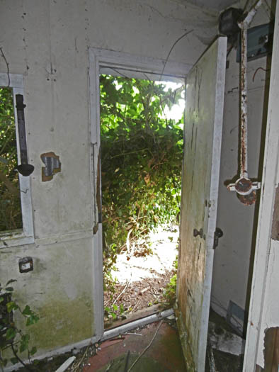
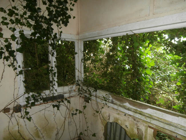
Not much of a view over the Admiralty Rifle Range these days!
Return To Top Of Page
Keywords Admiralty Rifle Range Range Observation Post Folly Pier Waterworks West Weares Dorset
|