|

YOI, Salt Pans and a Dead Whale
There are two ancient salt pans [1] which may be of Roman origin but are more likely to be mediaeval. These are the sites of debris washed during Easterly storms such as a dead whale, a naval mine and the remains of Durdle Pier Crane which was destroyed in the great storm of 2015.
At the sites marked [2] are Grade II listed sewer vent pipes - one of the quirky things that Portland excels in having.
At [3] is an abandoned limekiln - now completely overwhelmed by brambles. Nearby are two cave systems [4].
Grove Road (The Grove) runs down towards the Youth Offenders Institute (YOI) [6] main entrance and has Alma Terrace [5] which is a block of terraced houses used, in decades past, by the staff from the prison which preceded the YOI.
The dominating feature of this part of Portland is the YOI located at [6]. This was built as Portland Prison and it opened its gates to criminals in November 1848. In 1921 the buildings and staff were converted into a Borstal for difficult lads and it remained as such until 1988 when it became the Youth Offenders Institute (YOI). In 2011 it became an adult and youth prison.
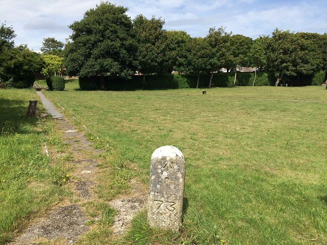
Located in the area [7] is the ‘Governer’s Garden’ which is open to the public and the Portland Prison Museum. An old marker stone can be seen in a garden [10] which is a part of Victorian history.
At [8] is a building which was once part of the World War 2 radar chain set up around Portland.
The abandoned Weymouth to Portland railway [9] runs through this area.
Finally there is a World War 2 pillbox teetering on the edge of a crumbling cliff at [11].
Please click here for a detailed map. Click the BACK button on your browser to return to this page.
Please click here to visit the satellite image of this area on Google Maps. Click the BACK button on your browser to return to this page.
Please click here to visit the Google Street View images of this area on Google Maps. Click the BACK button on your browser to return to this page.
|
Please use this table to navigate around this page
|
|
SALT PANS [1]
|

|
|
PRESERVED SEWER VENT PIPES [2]
|

|
|
A LIMEKILN [3]
|

|
|
TWO CAVES AND A MAN-MADE TUNNEL [4]
|

|
|
ALMA TERRACE [5]
|

|
|
PORTLAND PRISON - YOUTH OFFENDERS INSTITUTION [6]
|

|
|
GOVERNER’S GARDEN AND PRISON MUSEUM [7]
|

|
|
REMAINS OF A WORLD WAR 2 RADAR STATION [8]
|

|
|
PRISON PROPERTY MARKER [10]
|

|
|
WORLD WAR 2 PILLBOX [11]
|

|
|
Section removed - 2025
|

|
|
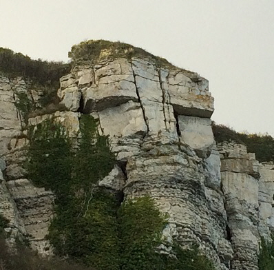
Overlooking this area is the glowering face of “The Portland Giant”
ANCIENT SALT PANS [1]
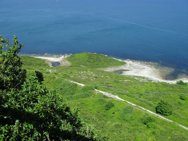
The two salt pans are the isolated pools of water near Folly Pier. In this picture taken from the top of the cliffs at the back of the YOI the abandoned railway line from Weymouth to Easton runs across the middle of this picture.
Ashley Smith’s historical website describing these salt pans can be found here.
The salt pans and other features in this area can be reached by descending the zig-zag path from this point at the back of the YOI.
This picture shows the northern salt pan. The area on the right is a much used spot for arranging rocks to spell out messages which can be seen from the road at the top of the nearby cliffs. Sometimes these messages are embarrassingly rude but most are welcoming messages to friends.
The southern salt pan is the more interesting as it contains the remains of a naval sea mine. Also many large wooden spars from Durdle Pier crane which was, until destroyed in the 2014 storm, in place further south down the coast.
In 1990 I discovered a large sea creature which might have been a whale in the southern salt pan.
This picture shows the southern salt pan. The sea is just over the stone embankment on the right. Seawater filters through the area on the right at high spring tides. When the sea level drops the sea water evaporates leaving a salt deposit. In mediaeval times this salt was a valuable commodity and was collected for personal use and for sale.
Also seen in the above picture is an old naval sea mine which is slowly rotting away.
This picture shows me posing with the remnants of the mine in 1989.
I discovered this creature washed up alongside the southern salt pan in 1989. It was very much decayed by the time I found it.
The length of this creature was about 4 - 5 metres and it appeared to have a tusk. There may have been two with the second tusk carried away by predators.
I did not have time to examine this creature in detail so I made a second visit a few weeks later. Unfortunately, someone had made a bonfire to destroy the creature and all that was left was a few heavily burned vertebrae and a pile of ashes.
Early in 2014 a violent storm hit the Portland coastline. Amongst the casualties of the gigantic waves that battered the coast was Durdle Pier Crane. The above picture shows this crane in place further south along the East Weares coastline.
The waves smashed the crane and parts of it were washed up at the southern salt pan.
Not only did the waves carry the huge wooden spars along the coast but they tossed them over the pebble bank and then up into the vegetation beyond the salt pans.
There is nothing left of the crane at its original site apart from a few bits of twisted and shattered metal.
Return To Top Of Page
PRESERVED SEWER VENT PIPES [2]
There are several sewer vent pipes in this area. One is down almost at sea level whilst the other three are in the area of the YOI. These are all protected with Grade 2 preservation listings.
The ventilator above stands on the cliff edge and is a prominent feature of the area. All these ventilators align with a main sewerage pipe built around 1870. This pipe runs down to the coast and used to discharge sewerage into the sea south of the salt pans.
A ventilator in the Governer’s Garden. Another can be seen to the right and in the distance.
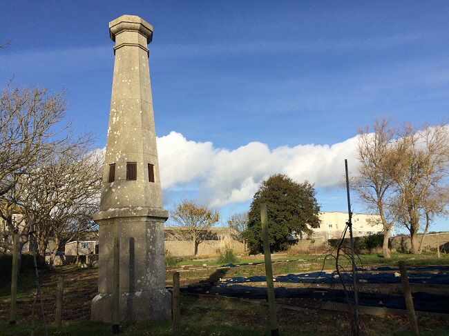
A ventilator on the stretch of sewer pipe as it drops down to sea level.
I pose by the seaward ventilator in 1989. This whole area is now so overgrown that this photograph cannot be reproduced today. That of course is a challenge to explorers who do not mind hacking their way through brambles to reach a nondescript tower of stone.
The disused sewer pipe as it enters the sea. All Portland’s sewerage now is pumped to the mainland at Wyke Regis where is is purified and sent into Lyme Bay.
Return To Top Of Page
A LIMEKILN [3]
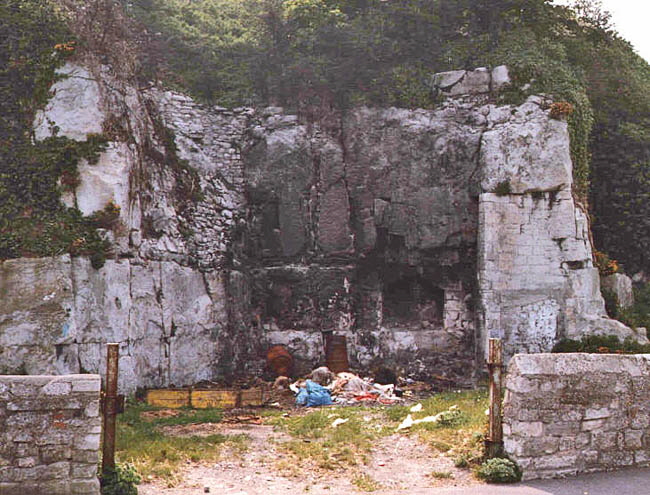
This old limekiln was photographed by me in 1989. It stands on the eastern boundary of the YOI next to the road that runs along the top of the cliff. Not long after this picture was taken a huge security fence was erected as shown below, which not only denied access to this artefact but also allowed it to be overwhelmed by brambles.
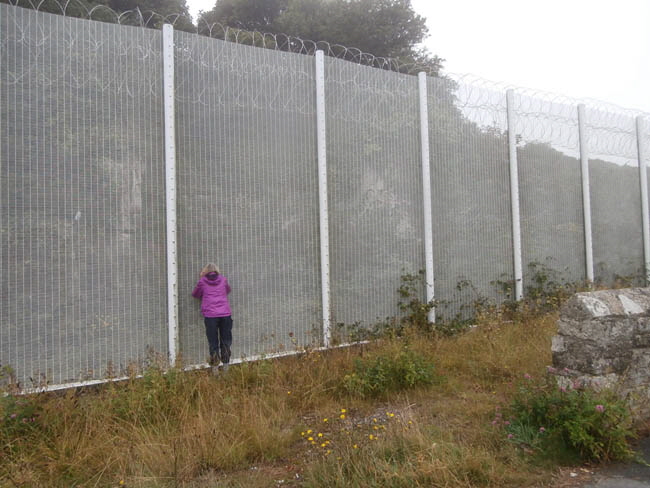
My friend Sandy peers through the security fence to try and spot the limekiln.
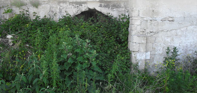
The view through the mesh of the security fence. The limekiln is in there somewhere!
Return To Top Of Page
TWO CAVES AND A MAN-MADE TUNNEL [4]
There are two cave systems on the cliff side of the road running along the east of the YOI. Both can be accessed with care and some danger.
The upper of the two caves is reached by climbing over the wall in the bottom right-hand corner of the above picture. There is a significant drop over the wall as shown by my attempts in August 2015 to reach this cave.
“I just heard something rip - I hope it was just my jeans!”
There is a track downwards from this point which is slippery and dangerous in wet weather. In dry weather it is just dangerous.
The picture above was taken in 1989 and shows my daughter and eldest son posing at the cave entrance.
My daughter ventures into the cave which has a twin rail system set in the floor.
Many years ago I was contacted by a visitor to this website who was a caver and he said that he had set up this rail system. It was to bring out debris on trolleys when he was with a group clearing the cave system.
I have never ventured very far into this cave system because there is a deep chasm about 8 metres from the entrance. I have failed to get over this deep hole.
Liam Deeney has ventured further and his pictures are shown below with his kind permission.
Copyright Liam Deeney
Copyright Liam Deeney
Copyright Liam Deeney
My picture above taken in August 2015 shows a warning sign on the cave entrance. I did not attempt to get into the cave because there had been torrential rain for two days and the approach path was dangerously slippery.
Many years ago I read that this cave continues towards - and possibly under the nearby YOI - and that it then continues for a long way towards the centre of Portland. In one place tar hangs down in strings from a point where a road passes overhead.
However, I have been unable to confirm any of these exciting possibilities. Until someone with more flexibility than me (I am aged 75 after all!) comes along with more information and evidence, this cave will be a mystery.
The lower cave is approached from the zig-zag path starting at the ‘goat gate’ near the ventilator.
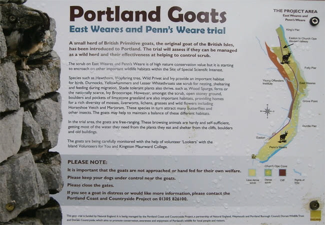
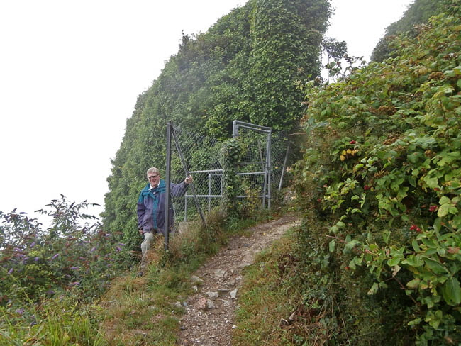
A short distance down the zig-zag path is a concrete pipe emplacement (is this ‘Ye Old Donovan’s Drain’ made famous by the signpost at the top of the path?) To get to Flagpole Cave carefully manoeuvre around the security fence - it is possible with great care. Make a mistake and you will fall a long way down a cliff covered in brambles!
Once round the fence follow a steep sloping concrete slab which is behind me in the above picture.
The entrance to Flagpole Cave is just around this corner as seen below.
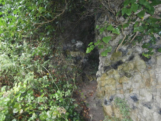
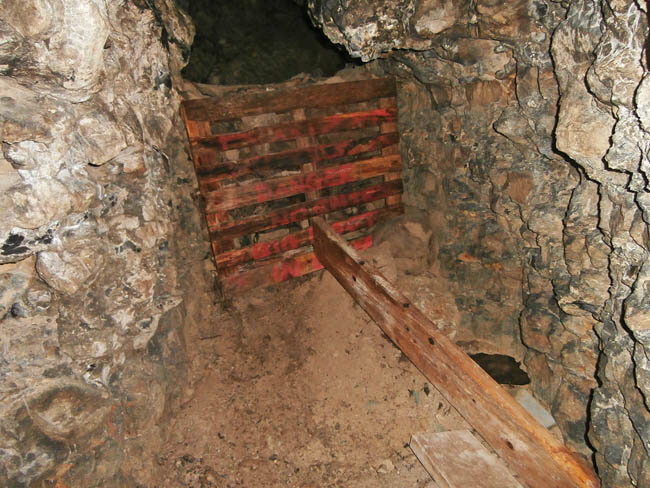
The entrance to Flagpole Cave is up this steep slippery slope. The cave passage is fairly wide and high and opens out after about 10 metres into a small cavern. However, at this point the cave system has been blocked by a wooden barrier strengthened by a pile of rocks.
A man-made tunnel runs from a manhole cover in the YOI car-park all the way down to a point just above the abandoned railway line. This tunnel carries a waste water pipe and steps to allow access. A YouTube movie of the exploration of this tunnel by Neil Ansell and friend can be seen here and here.
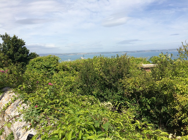
Near to the top of this path down to the sea stands a sentry box; a memory of the days when the Royal Navy practised rifle shooting on the near-by range - see web page north of this one. This box has been overcome by brambles such that only the roof is now visible.
Return To Top Of Page
ALMA TERRACE [5]
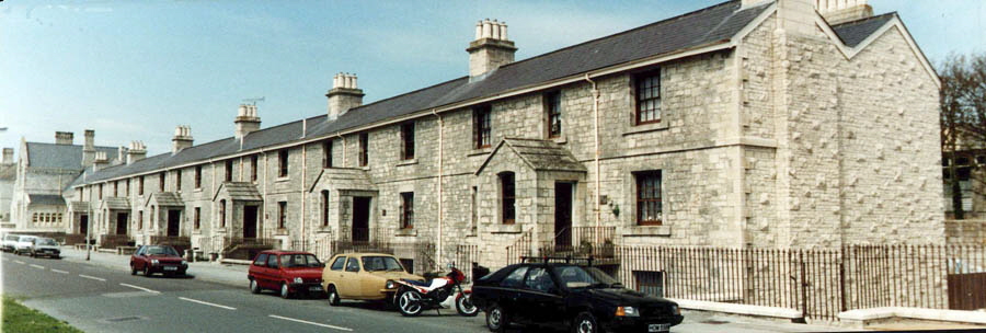
Alma Terrace was built in 1854 and was used to house staff at the nearby Grove Prison. This picture is from the early 1990s before a huge security wall was built to the right of these houses and this extended down to the prison main entrance.
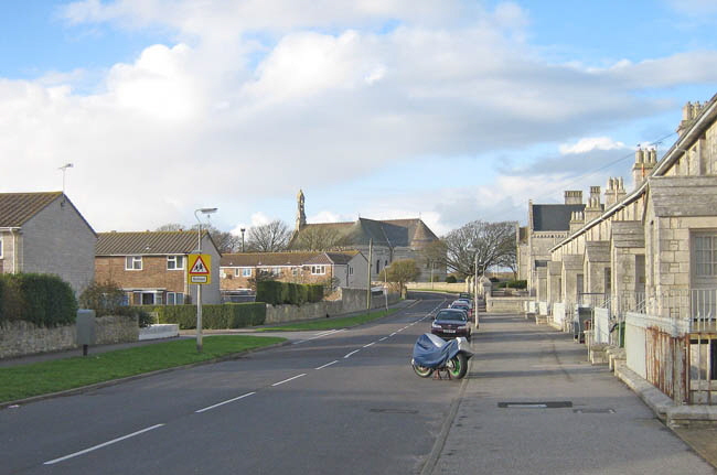
This view up Grove Road shows Alma Terrace on the right. On the left is the Rufus Way estate. This estate is built on an abandoned quarry. In the distance we see St Peter’s church.
The above picture shows the previous modern view as it was about a century previously. Convicts are trundling a cart up Grove Road passing Alma Terrace on the right and the quarry on the left is where Rufus Way now stands.
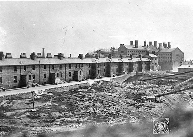
This view from about a century ago shows Alma Terrace in the background with the abandoned quarry in the foreground upon which the relatively recent Rufus Way estate was built.
Notice in the above picture that Alma Terrace was longer in those days and extended almost down to the prison main entrance. The houses with the double storied porches were the ones demolished.
This picture from 2003 shows building work in progress within the YOI and it was around this period that the outer high security wall was extended.
I took this picture standing a little way off Grove Road (The Grove) to show the dominating and forbidding security wall adjacent to Alma Terrace. I am standing very close to the spot where The Grove Inn once stood as can be seen by comparing the background buildings of the prison in the picture below.
There were once six public houses in The Grove whose business relied in various ways on the presence of the prison. They were frequented by prison staff, visitors to the prison and those who came all the way from London just to watch the prisoners working in the nearby quarries.
Return To Top Of Page
PORTLAND PRISON AND YOUTH OFFENDERS INSTITUTION [6]
There is much information in Stuart Morris’s “Portland - An Illustrated History” book as well as his many other books.
There is also a detailed history of Portland Prison and its conversion in the 1920s into a Borstal for wayward youths which can be seen here. Other good sources of information are the Portland Museum near Pennsylvania Castle and the Portland Prison Museum which is near the YOI main entrance.
There are many old pictures at the Portland Museum Archive which can be seen here.
Opened in 1848 it was a very tough prison with the prisoners working long and hard in the surrounding quarries.
My picture taken from Weston using a 200 mm lens in 1990 shows how the buildings dominate central Portland. The gloomy and austere prison casts a sombre and threatening presence.
The Victorian entrance is still the way in and out for criminals and it now has protected status. Below we see the entrance in use a century ago.
James Burgess who joined Portland Prison in 1850 and retired in 1871. He has been immortalised by appearing top left on a decorative plaque outside the TESCO store at Easton as seen below.
This picture shows the small cells that the prisoners occupied. This was their world when not out working in the quarries.
The prison at about the time it became a Borstal.
In 1921 the prison was converted to take Borstal Boys of whom the above is an example. More pictures of Borstal boys and their sporting activities can be seen here.
In 1988 the buildings were again changed to accommodate criminals entering as the Youth Offenders Institution (YOI) which it remained until 2011 when young adults were admitted.
Return To Top Of Page
GOVERNER’S GARDEN AND PRISON MUSEUM [7]
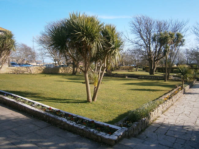
Recently the Governor’s Garden has been opened up to the public for recreation. This is located almost opposite the main entrance of the YOI. There is a children’s playground in one corner and the Portland Prison Museum is located in a building within the garden.
Here we see one of the sewer ventilator towers in the area. These are protected and listed structures.
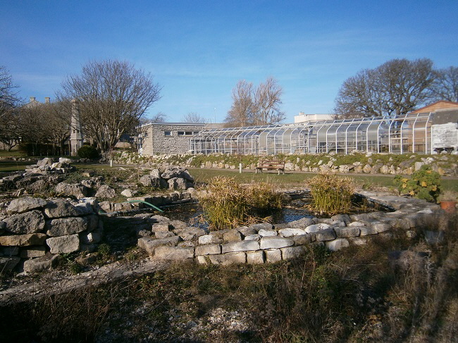
The display on the left of the above picture has an example of every wild flower type growing on Portland.
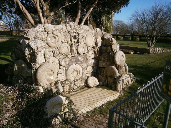
A Fossil Seat in the Governor’s Garden.
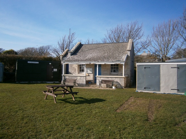
The old pavilion. This area used to be tennis courts but later became a bowling rink.
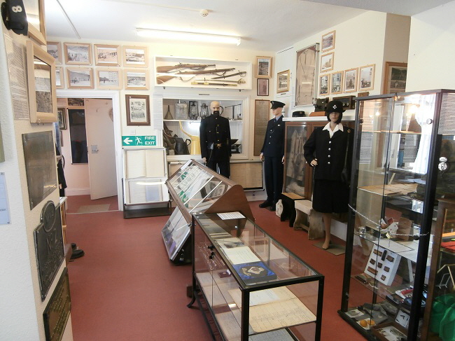
There is a small but interesting museum based on the prison. This is open between 10 am and 2 pm from Thursday to Sunday in the summer months.
Return To Top Of Page
REMAINS OF A WORLD WAR 2 RADAR STATION [8]
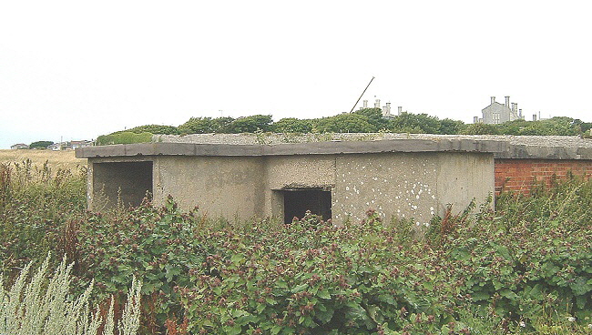 . .
This brick utilitarian building stands at the south end of the Governer’s Garden next to the South West Coastal path which runs along the edge of the cliffs. Its origin is unknown but it has all the unimaginative design and construction features of a World War 2 building - possibly a lookout.
The Heritage Gateway (please click here) describes this building as follows
“Military building (wartime?), single storey, brick, with flat concrete roof. A smaller concrete building is just NE. Probably WWII. Function uncertain. Close to edge of Broadcroft Quarry. Used as stable in 2007. The building and a second one immediately to the north are visible as structures on aerial photographs of the 1940s.”
However, Ashley Smith has researched this building and his description can be read here. This is actually a World War II Coastal Defence/Chain Home Low (CD/CHL) radar station designated M73.
It was built early in World War 2 to monitor shipping and aircraft during the war.
An aerial would have been mounted on the roof and the site was operated by the RAF.
Return To Top Of Page
PRISON PROPERTY MARKERS
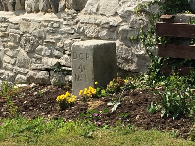
The above boundary marker is in a garden in Shepherds Croft and the one seen below is in the Governer’s Garden.
A WORLD WAR 2 PILLBOX [11]
A short distance north of Folly Pier is a World War 2 pillbox. Built in the early days of the war it has now on the edge of a crumbling soft Kimmeridge Clay cliff as shown above.
I have climbed up this difficult cliff to explore the building whose history is described here.
Climbing this crumbling cliff is intimidating because the pillbox is overhanging the edge and looks as though it might fall on me.
The inside of the pillbox is relatively clean although there is some sign of parties having been held here. Why would people go to all the trouble of getting to Folly Pier, scrambling up a dangerously crumbling cliff and forcing their way through brambles to get to the entrance - whilst carrying cases of canned drinks?
Return To Top Of Page
Section removed - 2025

Book section now removed. (16 July 2025).
Keywords Youth Offenders Institute Salt Pans Dead Whale West Weares Dorset
|