|

“Forbidden City”
Page and some links last revised/updated 3rd April 2025.
This large area of Portland is a mysterious and rather spooky collection of buildings ranging from Victorian military emplacements to a more recent military training area.
Its mystery arises because it has, for over a century, been closed to the public. Originally access was stopped when the Common Land was taken from Portlanders to expand the Royal Naval Dockyard.
In more peaceful times the area was acquired by Portland Port and their security is every bit as tight as the Ministry of Defence’s ever was.
And so this area has acquired the local name of “The Forbidden City”.
Although public access is forbidden, pictures have appeared taken by intrepid explorers who have dodged CCTV cameras and security guards to show the rest of the world what exists in this area. An example of these explorations can be viewed here.
The building that existed at [1] was the main building of the Admiralty Underwater Weapons Establishment (Sonar Department). This huge building was demolished in about 2005. There are pictures included below for continuity although it falls in the area north of this page.
The whole area of “The Forbidden City” [2] covers over 10 hectares; much of it impenetrable brambles.
The HMS OSPREY buildings [3] have long ago been demolished.
Please click here for a detailed map. Click the BACK button on your browser to return to this page. Please click here to visit the satellite image of this area on Google Maps. Click the BACK button on your browser to return to this page.
|
Please use this table to navigate around this page
|
|
AUWE SONAR DEPARTMENT BUILDINGS [1]
|

|
|
“THE FORBIDDEN CITY” [2]
|

|
|
HMS OSPREY BUILDINGS [3]
|

|
|
AUWE SONAR DEPARTMENT BUILDINGS [1]
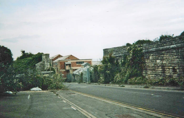
This photograph was taken in about 2002 and is looking back down Incline Road toward Portland Port. The girder railway bridge has been removed. Beyond the abandoned security gate is the main building of the Admiralty Underwater Weapons Establishment (AUWE) which was within the Naval Base. The southern part of the AUWE establishment was at Southwell - please click here for details of that establishment.
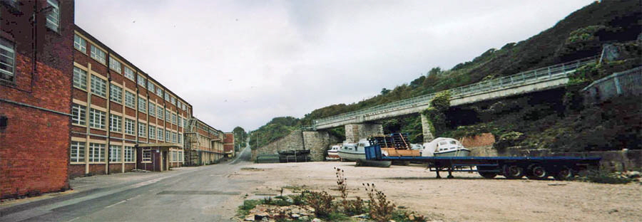
The main building of the Sonar Research Department of AUWE is on the left. The girder railway bridge has been removed at the bottom of the Incline Road but another disused railway bridge can be seen on the right of the above picture. By 2005 the AUWE building had been demolished.
The view a century ago of the coastline just to the seaward side of the building in the previous picture. An old Victorian map shows the building on the far left to be a Coastguard building. This is where the Annex to the AUWE (Sonar Department) was in later years. The construction on the skyline on the left of the picture was part of the machinery used to operate the inclined cable operated railway that ran from the top of Portland down to the Navy Base. When the railway was removed it because ‘Incline Road’.
Return To Top Of Page
“THE FORBIDDEN CITY” [2]
The original buildings in this area were the gun batteries built in the 1860s to protect Portland Harbour. An excellent and detailed description of these batteries by Ashley Smith can be read here. There is also a map showing the layout of the batteries here.
The East Weares Battery in the 1880s.
In the last years of these historical gun batteries being in Royal Navy possession they were used for training purposes, including DISTEX Disaster Training. During these operations some of the Victorian buildings and gun emplacements became much damaged.
Four of the East Weare gun batteries are within the secure area of Portland Port and two are outside the fence. In theory these latter two batteries are open to the public but, in reality, these are so overgrown and surrounded by brambles that there is no guarantee that you will be able to get to a gun battery.
Should you wish to try to get to one of these gun batteries go to the Royal Naval Cemetery. Walk on the Tarmac path past the cemetery and watch out for a difficult gap in the left-hand brambles. This is 100 metres from the eastern end of the cemetery. If you arrive at the Portland Port secure fence without finding this gap retrace your steps. If you still cannot find the gap then it is so overgrown that you will not get to the Gun Battery without a machete, flame thrower or by blundering through wearing a suit of Mediaeval armour.
If the gap is passable (I and others do try to keep it open) follow the narrow path down and you will come to an armament storage building.
The building you reach is just glimpsed in the middle left of the above picture. I have outlined it to make it more recognizable. What appears to be a stone seat on the top of an earth mound is a ventilator for another armaments storage building. I have never, in thirty years of trying been able to reach that particular building due to impenetrable brambles. The most easily accessible building is the one shown below.
The above picture shows the armaments storage building in about 1990 and the lower pictures was taken in 2011.
Several attempts have been made to stop people getting into this building but as soon as the entrances are bricked up, those entrances are smashed open again.
I took the above picture in 2002 and the building was then in quite a good condition. It was possible to get in and explore with a good torch. The area around the building changes from one year to the next. Sometimes the building is submerged by brambles and then it is cleared. In recent years it has been a meeting places for local gangs who leave behind evidence of their visits by piles of drink bottles and cans, remains of fires and even old items of bedding. What state this building will be in when you visit is unpredictable.
This picture was taken in 2014 and shows the building returning to nature. Hidden behind the brambles in the lower right of the picture were piles of rubbish left behind from many parties held here.
Deeper into the often impenetrable jungle of brambles is this gun emplacement which I have managed to reach a few times over the last twenty-five years. The East Weares Camp was built west of the gun batteries near to the foot of the cliff that rises up to The Verne Citadel. Ashley Smith has provided a history of the camp here.
It was built as a detention barracks and it was converted to coastguard use in 1914. Later on it fell into disuse until the Royal Navy used it in the 1980s and early 1990s for disaster training exercises. The following pictures have kindly been supplied to me by “Aslanman” and Andrew Blackmore to illustrate typical features in “The Forbidden City”. There are many more pictures - most supplied by “Flyjoy” on Ashley Smith’s website here and Andrew Blackmore has an album of excellent pictures here.
Copyright “Aslanman” and reproduced here by kind permission
Copyright “Aslanman” and reproduced here by kind permission
Copyright “Aslanman” and reproduced here by kind permission
Copyright “Aslanman” and reproduced here by kind permission
Copyright “Aslanman” and reproduced here by kind permission
Copyright Andrew Blackmore and reproduced here by kind permission
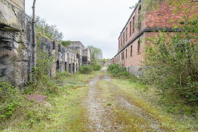
Copyright Andrew Blackmore and reproduced here by kind permission
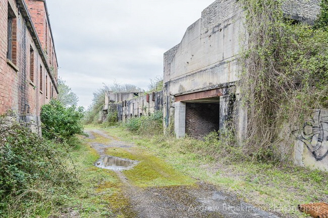
Copyright Andrew Blackmore and reproduced here by kind permission
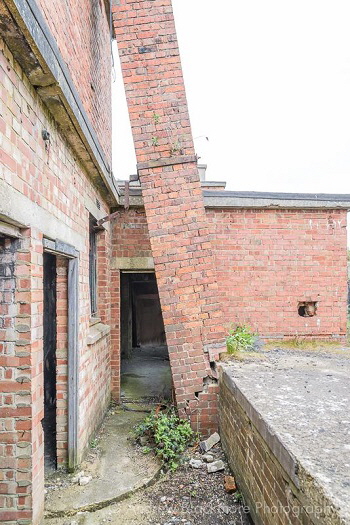
Copyright Andrew Blackmore and reproduced here by kind permission
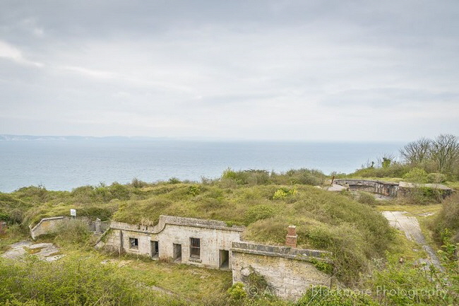
Copyright Andrew Blackmore and reproduced here by kind permission
Return To Top Of Page
HMS OSPREY BUILDINGS [3]
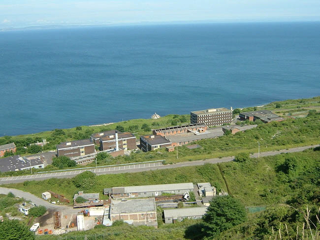
These are the buildings once occupied by HMS OSPREY but then abandoned when the Royal Navy left Portland and moved to Plymouth in the mid-1990s. There is a detailed history of this site here and another here gives a detailed description of the operational side of the air station.
The road running across the picture is Incline Road which ran down from Tophill to the Royal Naval Dockyard. It is now gated and unused. This road was once the line of a cable operated railway used for getting stone blocks down to the dockyard for building the Portland Breakwater.
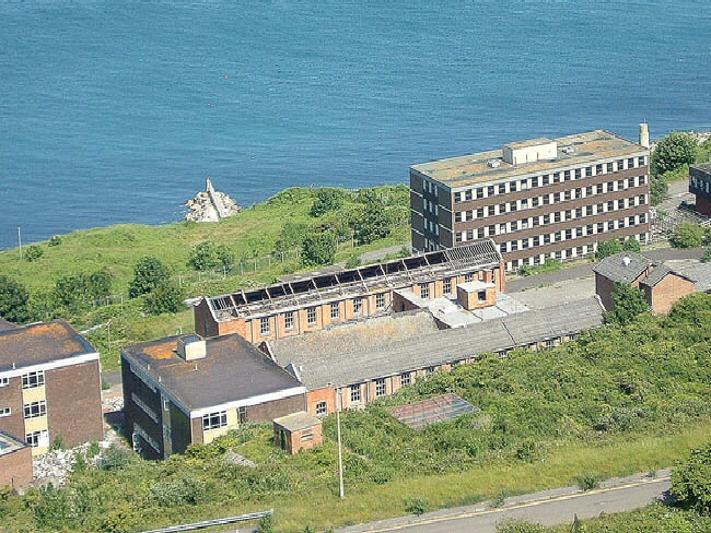
This view of HMS OSPREY main building was taken in the late 1990s and shows the buildings decaying through neglect. King’s Pier can be seen jutting out to sea. This marks the boundary of the Portland Port property - note the security fence on the pier.
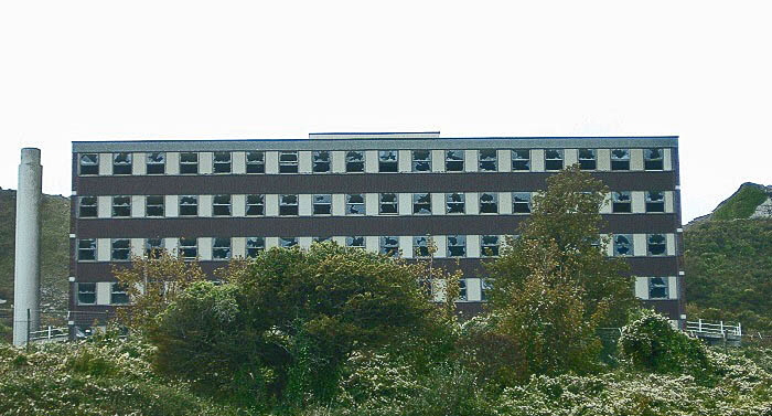
Every window smashed!
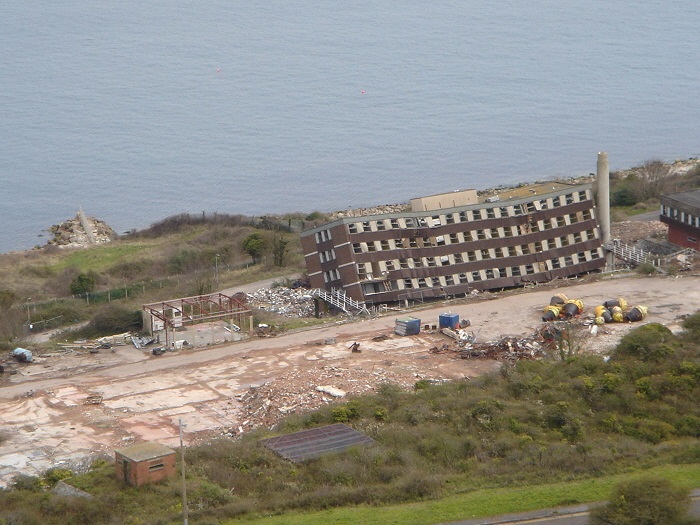
The final collapse of the HMS OSPREY main building in 2006 as photographed by Derek Why.
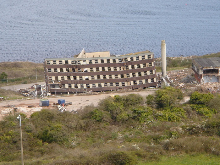
This site was soon cleared and plans were proposed to create huge caverns deep underground at this place for the storage of natural gas.
However, these plans fell through and a new plan was put forward to use the site for the generation of electrical energy by burning imported palm oil. This met with vigourous opposition from Portlanders. More recently the plan changed to using old car tyres to generate energy, diesel fuel and LPG. This plan is still extant although nothing has yet happened - please see here for details.
Return To Top Of Page
Return To Top Of Page
Keywords HMS OSPREY DISTEX East Weares Gun Battery Forbidden City West Weares Dorset
|