|

Castletown
Page and some links last revised/updated 12th February 2025
|
|
|
© OpenStreetMap contributors - see http://www.openstreetmap.org/copyright
|
|
This area includes the heart of Castletown; an old fishing community which became, in early Victorian times, the central collection point for much of the stone taken off Portland.
Castletown was also the gateway to the huge Royal Naval Dockyard with all the essential trappings - pubs, cafes, a naval outfitters, more pubs, hotels - and, oh yes! Even more pubs!
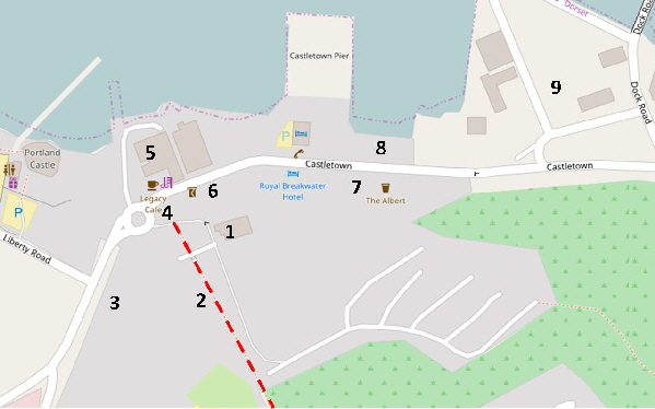
This map area covers the bottom of the Merchants Railway where it ends its descent into Castletown. This is shown on the map as a dashed red line.
It was forecast that the departure of the Royal Navy in the mid-1990s would bring disaster and ruin to Castletown. There were some casualties (such as the Greasy Spoon cafe) but the area revived a little with services opening up for sport divers, workers at the Portland Port, etc. However, by 2015 practically all the diving support infrastructure had relocated, mostly to new premises within the nearby National Sailing Academy.
Portland Port, which acquired the old Royal Naval Dockyard, has also become a major hub for cruise ships although the thousands of short-term tourists don’t usually look around Portland.
However, in June 2015 a tour was organised for a visiting cruise ship taking in the delights of Portland which was very successful so let’s hope more cruise ship visitors head south from Portland Port rather than going off Portland.
In June 2015 local entrepreneur Derek Luckhurst put forward plans to re-vitalise Castletown with new facilities, museum, etc, - please click here for details. As reported in the Dorset Echo
“A museum, underwater diving park and American themed D-Day attraction are part of new plans to regenerate a harbour gateway on Portland and bring Castletown 'off its knees'”.
One of the enterprises has been the opening of the D-Day Museum which is proving to be a great success.
Please click here for a detailed map. Click the BACK button on your browser to return to this page. Please click here to visit the satellite image of this area on Google Maps. Click the BACK button on your browser to return to this page. Please click here to view the Google Street View images of this area. Click the BACK button on your browser to return to this page.
Stuart Morris’s essential book “Portland - An Illustrated History” is a major source of information on this area. A recent and comprehensive description of Castletown by Ashley Smith can be read here. The older buildings are described in Eric Ricketts’ book “The Buildings of Old Portland”.
An informative blog which guides us through the detailed history of Castletown and its residents, can be found here.
We start our exploration of Castletown from the west and we will move along to the entrance of Portland Port’s extensive industrial area at the eastern end of Castletown.
|
Please use this table to navigate around this page
|
|
THE ROYAL NAVAL HOSPITAL [1]
|

|
|
FOOT OF THE MERCHANT’S RAILWAY [2]
|

|
|
‘OCEAN VIEWS’ - THE EX-ADMIRALTY ACCOMMODATION BLOCK [3]
|

|
|
LEGACY MONUMENT [4]
|

|
|
OSPREY LEISURE CENTRE [5]
|

|
|
WEST CASTLETOWN [6]
|

|
|
D-DAY MUSEUM
|

|
|
PREPARATION FOR D-DAY
|

|
|
EAST CASTLETOWN [7]
|

|
|
THE BEACH [8]
|

|
|
PORTLAND PORT [9]
|

|
|
ROYAL NAVAL DOCKYARD [9]
|

|
|
ROYAL NAVAL SEAPLANES AROUND WORLD WAR 1
|

|
|
This old and remarkable aerial picture shows the eastern part of the Royal Naval Hospital to the left of the Merchant’s Railway and the other part is to the right. In the foreground of the picture is Portland Castle. The black huts in the foreground and the surrounding area have now been developed as the Osprey Leisure Centre.
Many thanks to Pat Manxy Rider for making this fine picture available to me!
CASTLETOWN’S TWO HOSPITALS
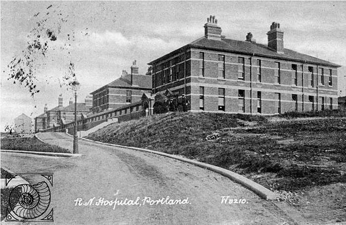
There have been two hospitals in Castletown. The NHS Hospital is described in another page of the website - please click here. The original and long demolished Royal Navy Hospital was divided into two parts with the Merchants’ Railway running between the two areas. The eastern and currently abandoned Royal Navy accommodation block stands where one half of the Royal Navy Hospital used to stand and the existing Portland Community NHS Hospital stands on the site of the western half of the Royal Naval Hospital.
Please click here to see an old Victorian map showing the layout of the buildings in the old hospital. Only the gatehouse marked ‘Mortuary’ has survived. NB: Due to a change in the external website the former direct link is no longer available. To see old mapping coverage of Portland the NLS Website is recommended. Reference updated February 2025.
There is an extensive history of the Portland Hospitals “A History of The Royal Naval Hospital Portland” by Reg Perry (May 1997) published by Artsmiths of Portland. There is also a comprehensive article which can be read here.
Return To Top Of Page
ROYAL NAVY HOSPITAL
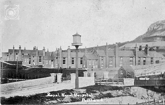
These buildings pictured in about 1905 housed those members of the Royal Navy suffering from infectious diseases and they stood where the currently abandoned Royal Navy Accommodation Block now stands to the east of the Merchant’s Railway.
The bridge connecting the two parts of the hospital which still passes over the abandoned railway line can be seen on the right in the above picture.
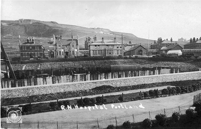
The eastern buildings. Note the roost on the tall pole for homing pigeons used for sending messages in Victorian times, the bridge over the Merchant’s Railway and the north entrance to the Verne Citadel on the hill top.
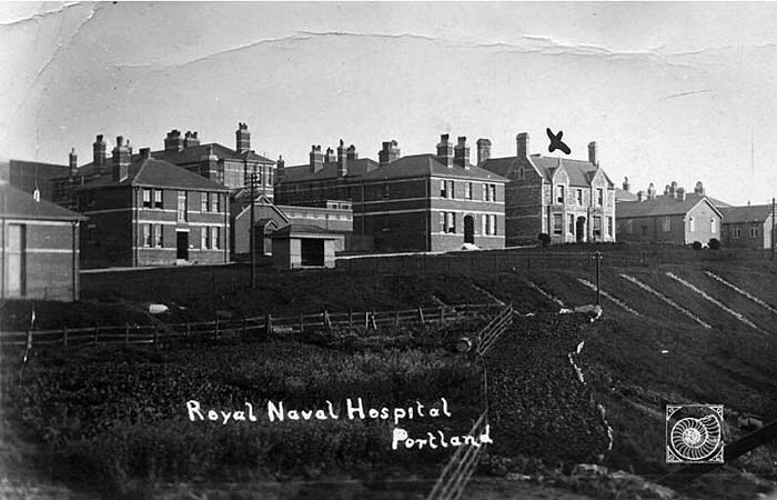
These buildings stood on the west of the Merchant’s Railway where the NHS Hospital now stands.
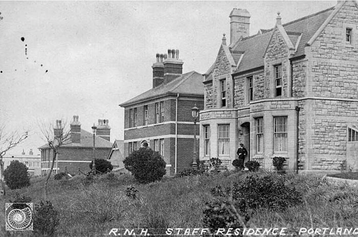
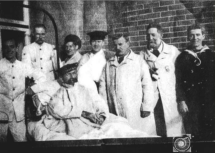
This picture shows Leading Boatman Arthur Lewis Harding RN in Portland Hospital recovering from injuries.
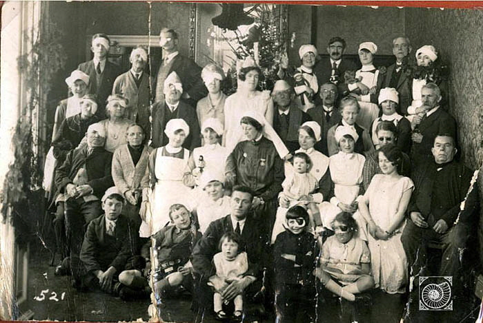
Staff and patients of the civilian hospital. This may be a Christmas party as many of the patients all have their left eyes patched up and some are wearing paper hats. There are more pictures here.
Return To Top Of Page
THE MERCHANT’S RAILWAY [2]
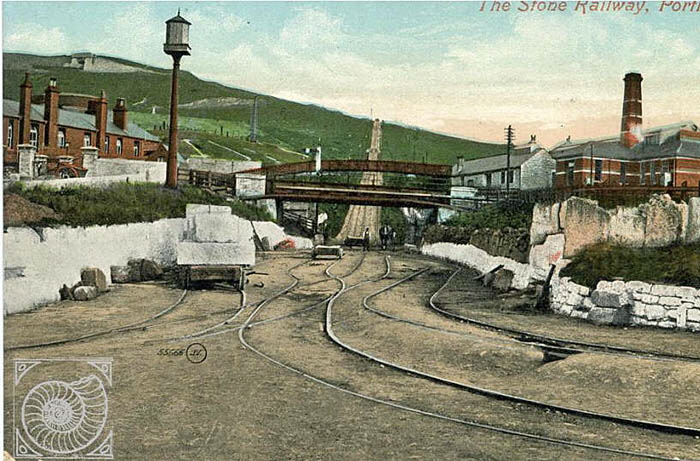
This old postcard shows how the Merchant’s Railway dominated the western part of Castletown. Opened in 1826, the Merchant’s Railway transported stone down from the quarries until the late 1930s. By this time road transport had made the old incline redundant.
There is an excellent video tour of the whole route of the Merchants’ Railway which can be seen here.
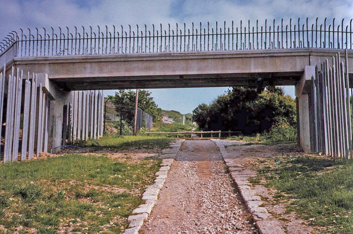
This photograph from 1989 shows how much the area had changed in fifty years. Gone were the old Royal Navy hospital buildings on either side of the track.
Looking back down the railway track in 2006 we see that the path is still open and clear.
By 2015 the track was beginning to be seriously encroached upon by vegetation such that a casual visitor might not realise that one of the earliest railway tracks in the country was hidden away just off the main road as shown below.
Spot The Railway Track Entrance!
The start of the inclined track is through the gap in the bushes just to the right of the ‘Legacy Monument’; a pillar made of many different samples of stone from Portland. In the background is the old Royal Navy accommodation block awaiting redevelopment into flats. The railway track is now just a memory represented by a few stone sleepers on which the rails were carried.
The above photograph shows the stones that carried the rails. The holes indicate where iron pegs were driven into the stones to hold the rails.
This picture shows a surviving iron peg. Maybe this is an original from 1829?
The railway was built to a gauge (distance between the inside faces of the rails) of 4 feet 6 inches which may well be unique in the UK. The modern standard of 4 feet 81/2 inches was not imposed in the UK until 1892 although it had first been used in 1825.
This old picture shows a truck loaded with stone descending under the force of gravity shackled to a cable which also bought up the empty trucks. The cross-over point is half-way down the incline and can just be seen.
A modern view from the top of the incline looking down to Castletown.
Return To Top Of Page
‘OCEAN VIEWS’ - THE EX-MINISTRY OF DEFENCE ACCOMMODATION BLOCKS
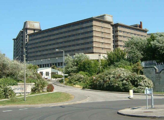
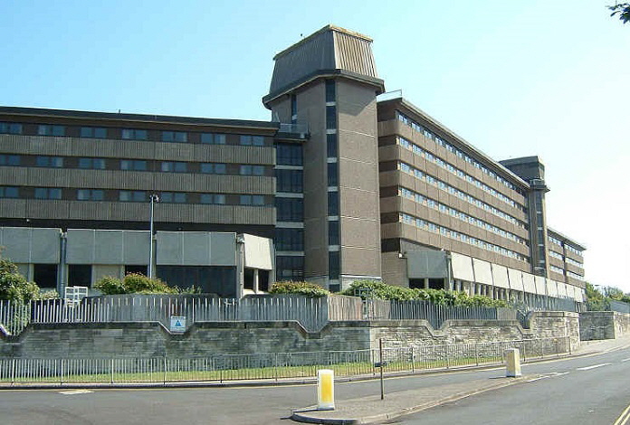
These huge blocks were built at enormous cost for the use of Royal Navy personnel. They were intended to avoid the use of local private guest houses and hotels for the accommodation of Royal Naval personnel and so were more than a little resented by local people. However, they were in use for only a short time before the Royal Navy left Portland in 1995 and the blocks became vandalised and derelict. Plans were put forward by the Government to house several hundred immigrants but, within twenty minutes of a protest meeting ending, arsonists had set fire to the buildings! Coincidence or what?
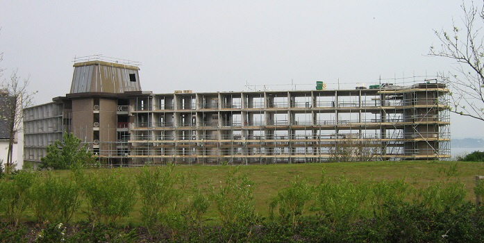
In 2006 the abandoned blocks were bought by Comer Homes Group.
After the completion of the first block, the Comer brothers made plans to prepare another block before developers Rossmark Properties, linked to the Comer Homes Group, went into administration during the recession and the land was taken over by the banks in 2011. The site was then purchased by Fulca Ltd, also part of Comer Homes, who in August 2014 expressed wish to restart the development.
For pictures taken inside these buildings during their demolition please click here.
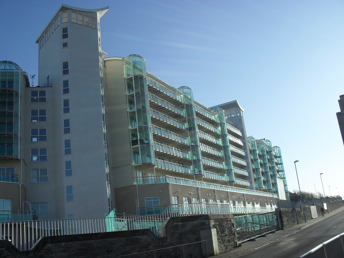
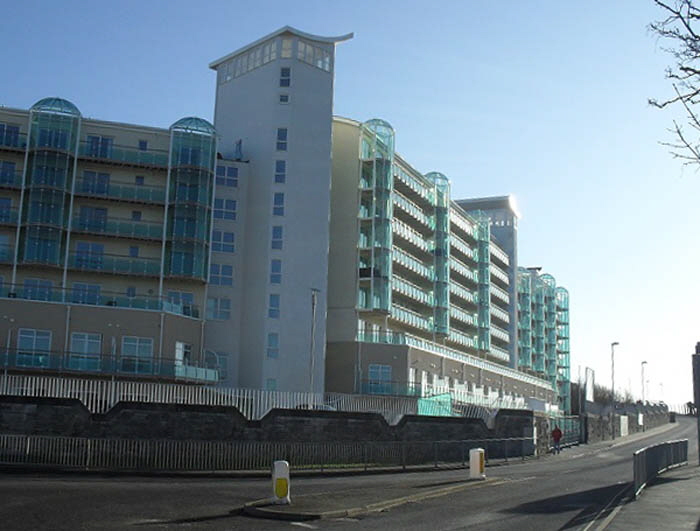
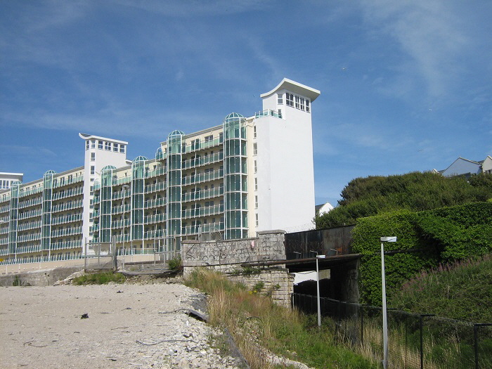
The above picture shows the route of the long-gone railway track on the right. The road bridge still exists although there are no signs left of the railway route.
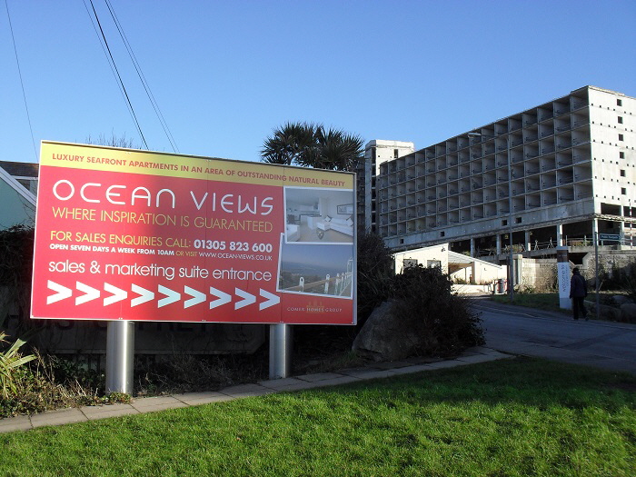
The eastern accommodation block was stripped out but, as of 2018, no attempt has yet been made to rebuild this building for housing.
Return To Top Of Page
LEGACY MONUMENT
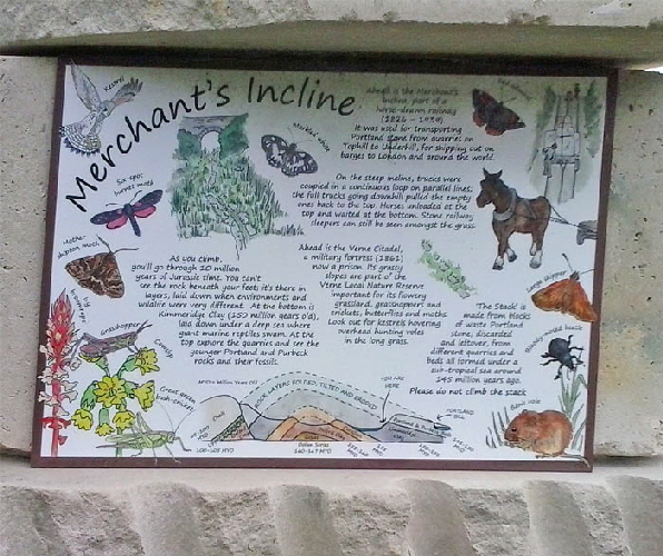
Several monuments like this have been erected around Portland to commemorate the 2012 Olympics. Another can be seen at Portland Bill.
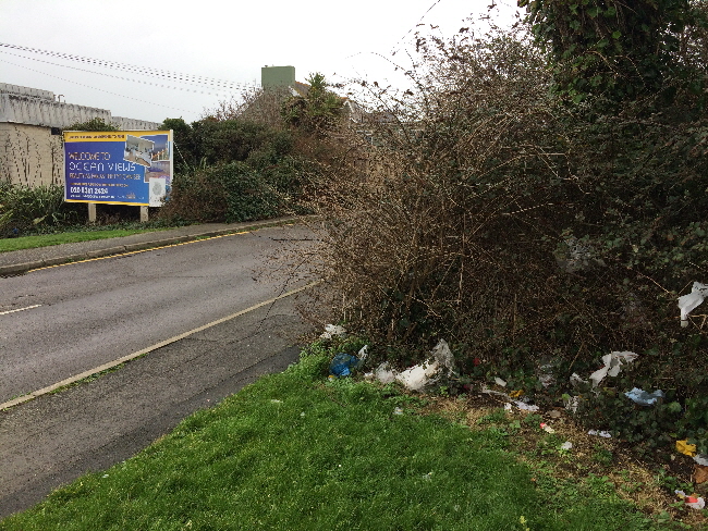
Unfortunately the area around the entrance to Ocean Views has become a dumping ground for rubbish.
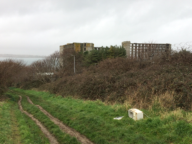
In addition, the old Merchants Railway track has also become a place where rubbish is dumped such as this microwave oven.
Return To Top Of Page
THE OSPREY LEISURE CENTRE
In the 1980s the Royal Navy built a state of the art leisure centre at the entrance to Castletown called The Boscawen Centre. When it was announced that the Royal Navy intended to close down Portland Naval Base a trust was set up to adopt the leisure centre for public use. This opened in May 2007 and the facilities were renamed The Osprey Leisure Centre in reference to the Naval Base’s name of HMS OSPREY.
The website for the Osprey Leisure Centre can be reached here and there is a comprehensive article about this facility by Ashley Smith here.
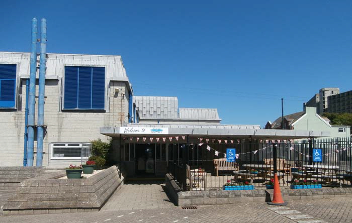
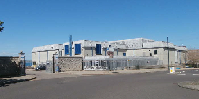
The Leisure Centre has a 25 metre Swimming Pool, a Gymnasium, Squash Courts and a Sports Hall all contained in the large building on the left of the above picture.
Return To Top Of Page
WEST CASTLETOWN
As we leave the modern Osprey Leisure Centre behind and walk towards the entrance of Portland Port we pass a interesting selection of shops and pubs.
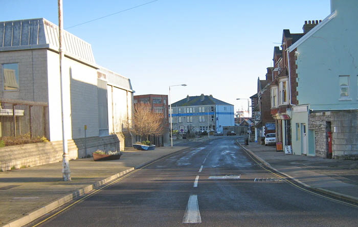
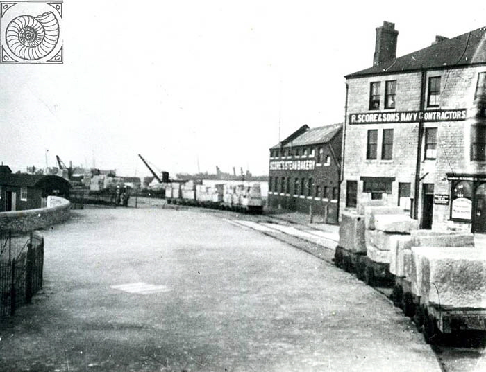
This old picture shows a much changed scene on the left where the low brick building has given way to the huge Osprey Leisure Centre. Note the building advertising ‘Gold Flake’ cigarettes. This building appears again below from further down the road. The buildings in the centre of the picture belonged to R. Score, Naval Contractor. This building survives as ‘The Aqua Hotel’. The smaller building in the centre of the pictures was the ‘Castle Hotel’ and is now an empty plot.
The ‘Gold Flake’ building appears above on the extreme right of the picture. The picture above and the one below show more or less the same scene but separated by about eighty years. Note that the whole area to the left has been demolished and redeveloped. Also note above the tramway rails on the right of the picture curving down from the Merchant’s Railway.
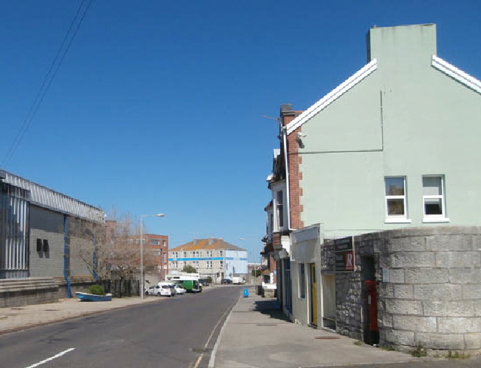
A close up of the ‘Gold Flake’ building on the right and an ancient wall which contains an Admiralty boundary marker and surveyor’s benchmark as shown below.
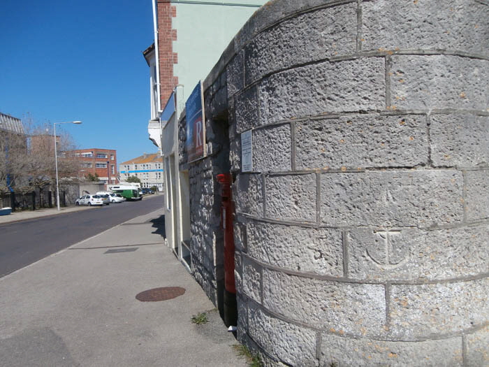
After the Royal Navy left Portland some businesses adapted to meet the needs of the many divers coming into this area - and were thriving - until those businesses moved to the nearby National Sailing Centre. For obvious reasons the shop of Gieves and Hawkes Naval Outfitters didn’t survive the Royal Navy’s departure from the area and the trade in the local pubs suffered.
One of the casualties of the loss of the Royal Navy is seen here in the early 1990s - the old ‘Greasy Spoon’ Cafe is boarded up on the left of this pair of shops. The post office seen here was robbed in an horrific knife attack in November 2003.
In 2015 the ‘Castletown Stores’ was empty with an empty shop next door which had been the ‘Greasy Spoon’ cafe in the days when the Royal Navy was still at Portland.
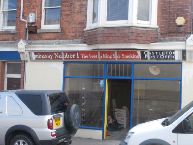
In 2016 the shop was converted into a show place for the local Agincare company. Briefly the original Post Office banner over the shop was revealed.
This road had been the route for stone to travel on horse drawn trucks to the loading jetty in the distance. The building in the centre of this picture was once the Salvation Army Sailors' Home. It later became the Aqua Hotel.
Note on the left a rowing boat with herbs growing in it.
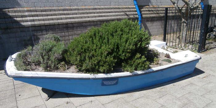
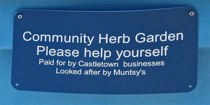
What a lovely idea!
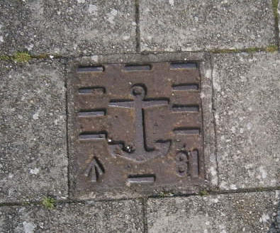
Embedded into the pavement near this point is an old Admiralty boundary marker.
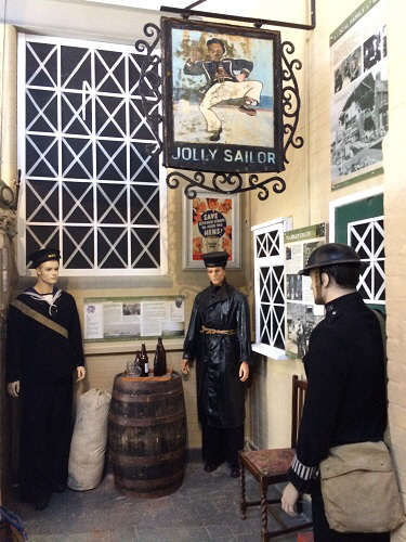
The Jolly Sailor pub was built in 1775 and was one of the first major buildings to be erected in Castletown. For over two centuries it made sailors jolly but fell into decay when the Royal Naval Dockyard closed.
In 2014 it was agreed to reopen the disused building as a care home for people with mental health problems - see the story here.
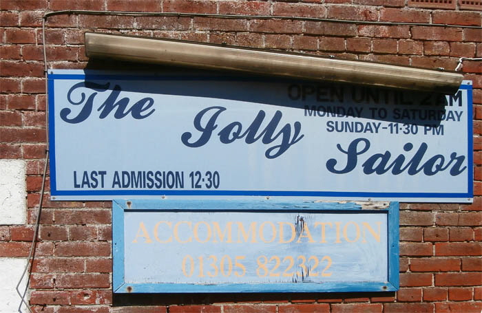
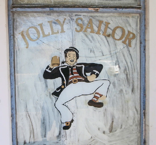
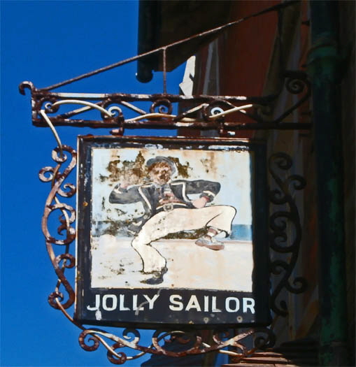
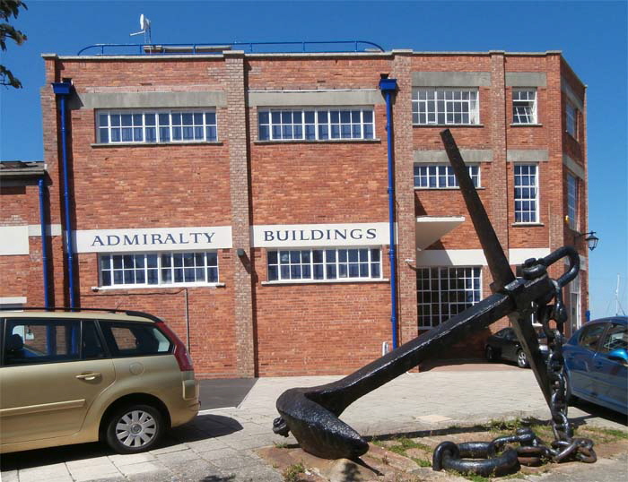
Almost opposite the decaying ‘Jolly Sailor’ pub is the ‘Admiralty Building’ which is occupied by ‘Agincare’ which provides in home and care home services (www.agincare.com) This building is not the original building with this name as the Victorian original was further north and has been demolished.
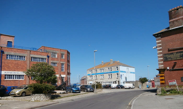
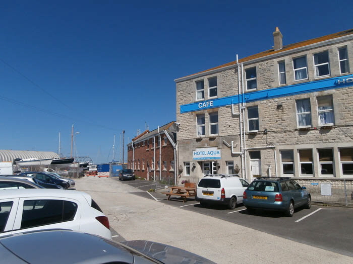
The modern view above compared with the old view below shows how the loading jetty has changed. Once it was a bustling area with wagons arriving from the Merchant’s Railway loaded with stone blocks ready to be loaded onto ships. Now is it a relatively quiet boat maintenance area with no sign of the former glory days of stone export and boats loaded with tourists arriving for a day out on Portland.
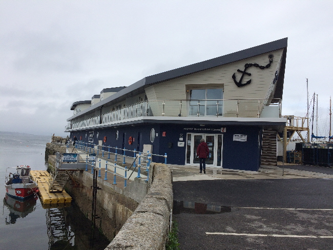
‘Crabbers’ Wharf’ is a new development on the stone jetty where, for centuries, blocks of stone were loaded onto boats to be taken all around the world. This building was designed to appear like a ship and it contains nine luxury holiday apartments. Each bedroom is en-suite and there is free Wi-Fi and parking - see here for details.
Return To Top Of Page
D-DAY MUSEUM
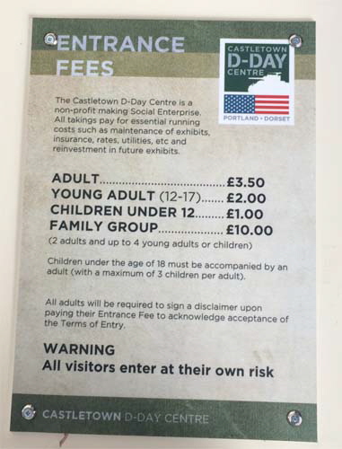
In 2015 the regeneration of Castletown got underway led by Derek Luckhurst who is the CEO of Agincare Ltd - see http://www.castletown.org.uk/ for details of this imaginative and important scheme. A centrepiece of the plan is a museum dedicated to the departure of US troops from Castletown in 1944. The following pictures were taken during a preview visit in March 2017.
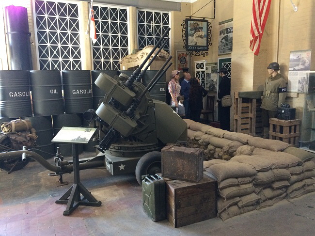
Note the recovered ‘Jolly Sailor’ pub sign hanging on the wall.
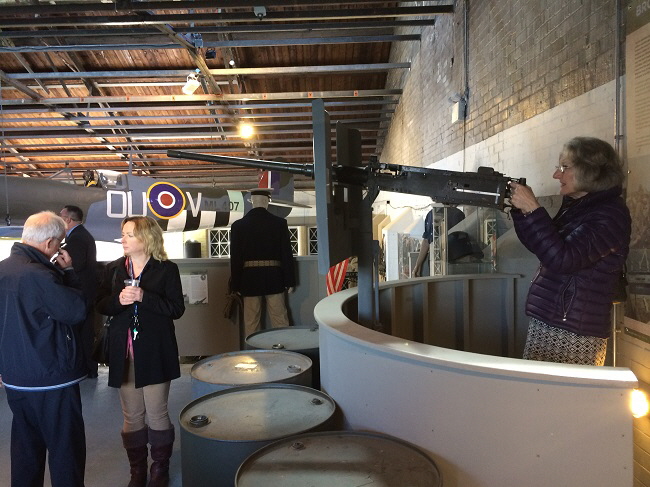
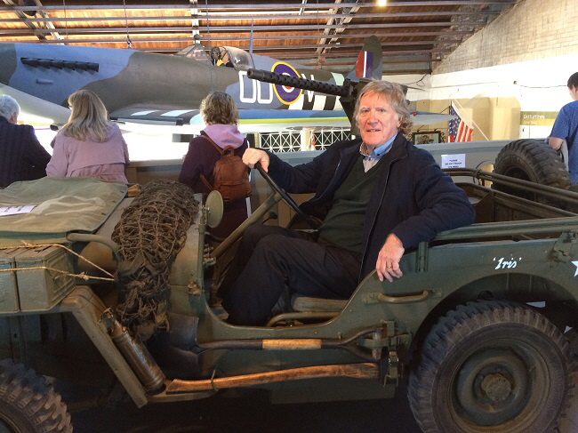
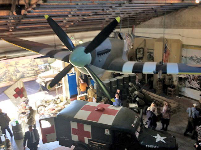
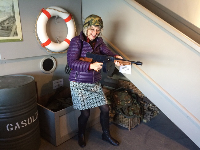
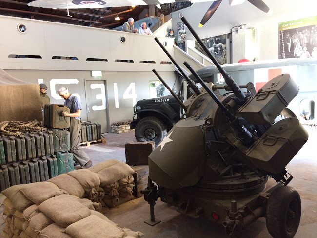
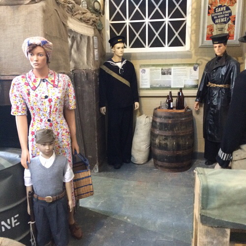
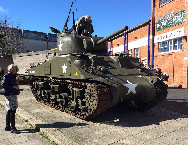
A Sherman Mk4 A4 tank manufactured in 1944. This saw action in Normandy in 1944.
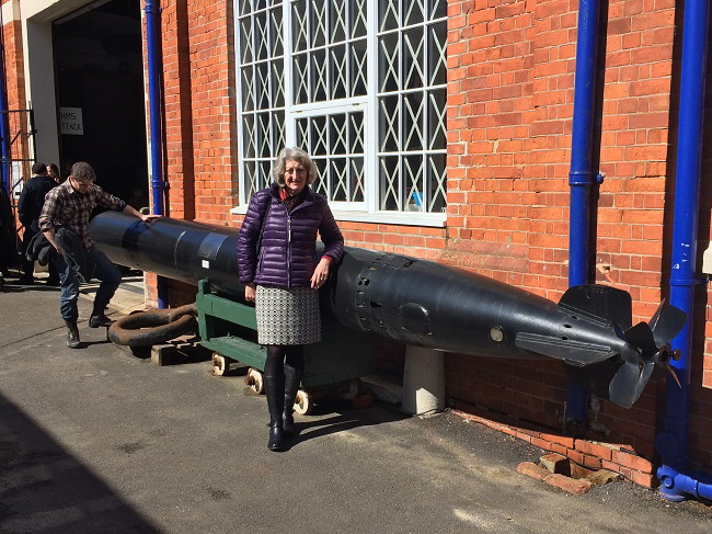
A Mark 8 torpedo of the type used extensively in World War II
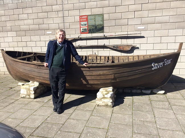
A Lerret boat of the type used locally on Chesil Beach. Very unusually it was pointed at both ends it could be more easily launched and recovered in high seas on the steep beach.
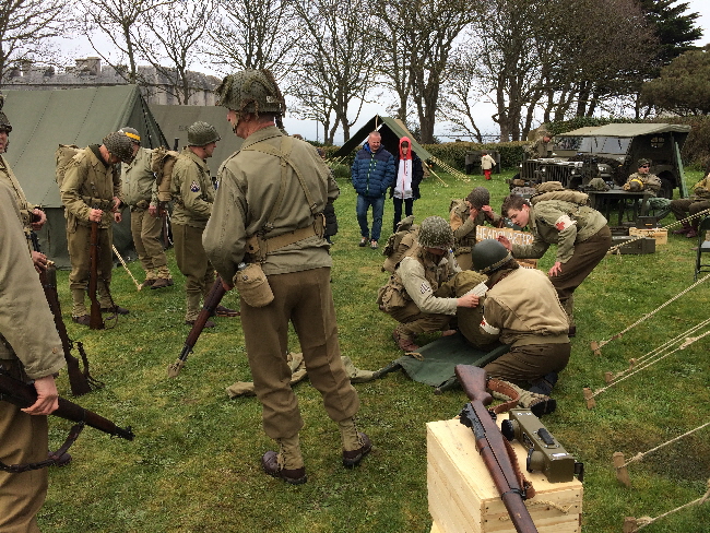
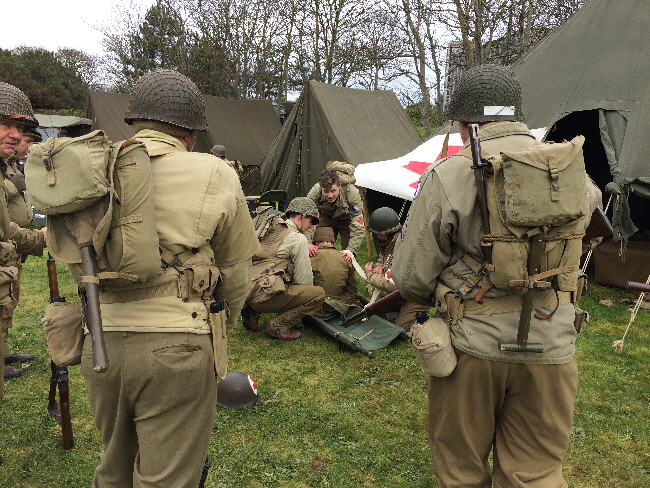
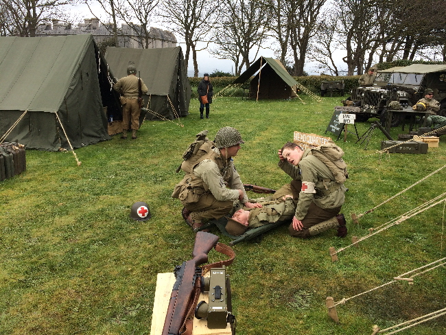
On 14th and 15th April 2018 a very successful event involving re-enactment group was held at the D-Day Museum and the nearby Portland Castle.
Return To Top Of Page
PREPARATIONS FOR D-DAY
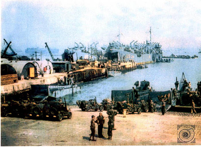
Castletown Pier was one of the main departure points for the ships carrying the invasion fleet which landed in France in June 1944.
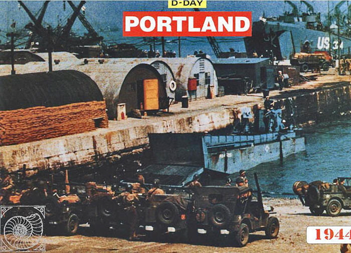
The story of Portland’s involvement in the D-Day invasion is very well documented in the book ‘Weymouth and Portland at War’ by Maureen Attwooll and Denise Harrison which is a paperback published in 1993. There is also an excellent collection of pictures of US forces at Castletown here.
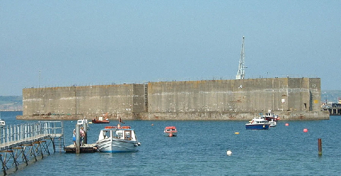
These two huge reinforced concrete floating barges are part of the ‘Mulberry Harbour’ scheme devised in World War 2 to protect the invasion forces on D-Day 1944. The history of these devices can be read here. A total of 148 units were built and these two units remain at Portland which date from 1944. They are approximately 60 metres long, 20 metres wide and 15 metres high. Each weighs 7,700 tons. Portland's two units became Grade II Listed in May 1993.
Return To Top Of Page
EAST CASTLETOWN
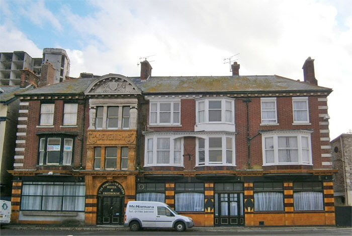
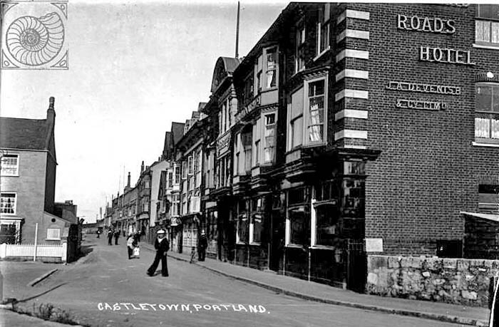
The Portland Roads Hotel has survived the downturn in local trade and is thriving. Below we see the hotel in an era when the Royal Navy provided a lot of business. The building on the left of the picture is the now demolished Castle Inn.
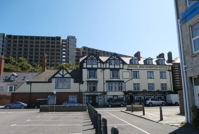
The ‘Royal Breakwater Hotel’ thrives despite the surrounding deprivation. Notice how the vast gutted Royal Naval Accommodation Blocks form a forbidding and depressing background to much of Castletown.
Opposite this hotel is a large car-park as seen below. A century ago a building stood where the car-park now exists as shown below.
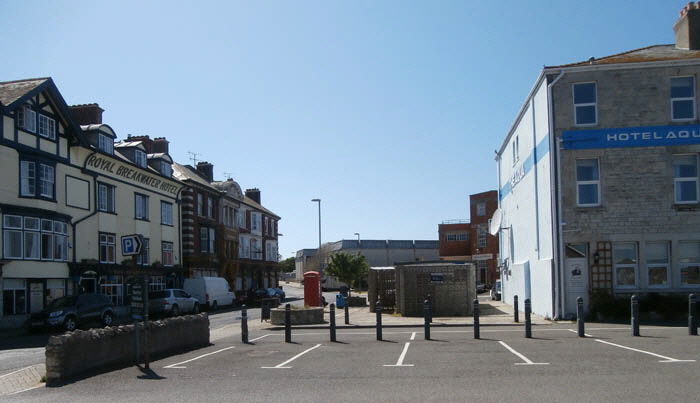
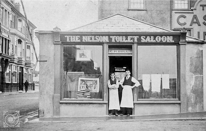
The Nelson Toilet Saloon a hairdressing shop. The proprietor was H. C. Bull. Note the piles of sailors’ hats in the window.
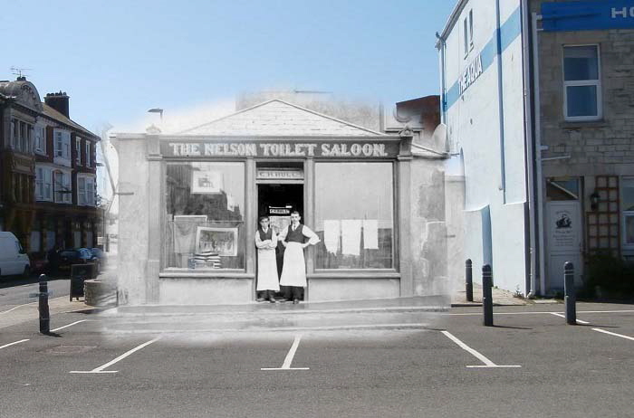
This is a blend of two photographs I have produced to show what the hairdresser’s shop would have looked like in a modern context.
A matching picture from long ago is shown below. At the centre is the ‘Green Shutters’ pub and hotel which was previously ‘The Albert’.
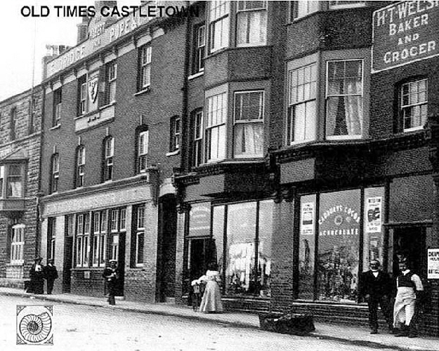
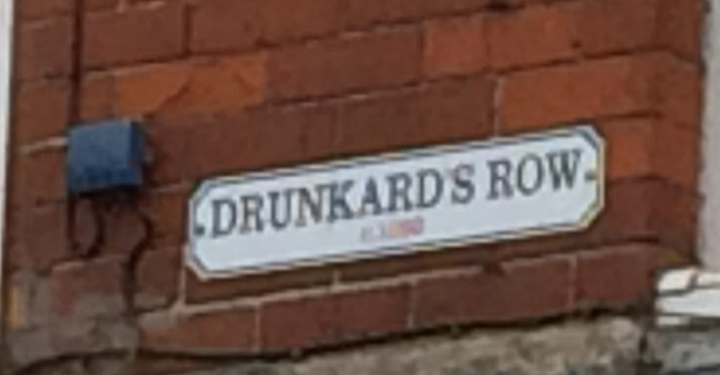
This area just outside the old Dockyard gates was notorious for the number of pubs and the drunken state of the sailors.
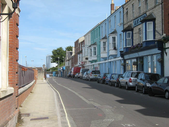
Looking down towards the entrance to Portland Port’s premises.
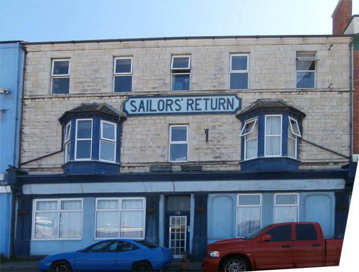
‘The Sailor’s Return’ - a popular name for pubs around Britain’s ports and harbours. This pub survives the trading downturn of the area.
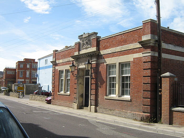
The Old Custom House.
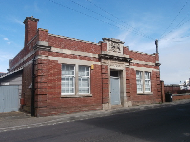
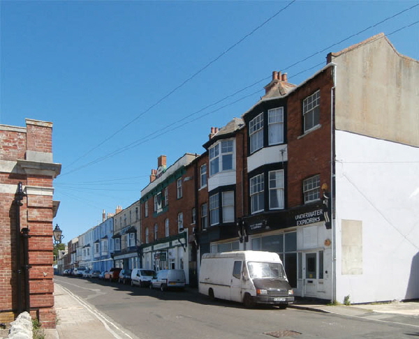
The shop vacated by ‘Underwater Explorers’ stands empty like so many other shops in the area.
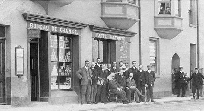
This picture from about a century ago shows the Post Office when it was thriving centre for the Royal Naval comings and goings. It was then situated close to the Dockyard entrance.
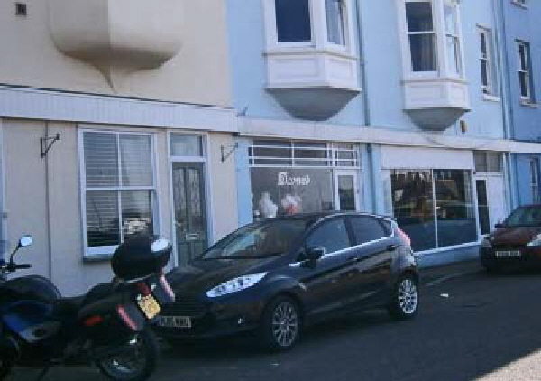
This is the building where the Post Office existed.
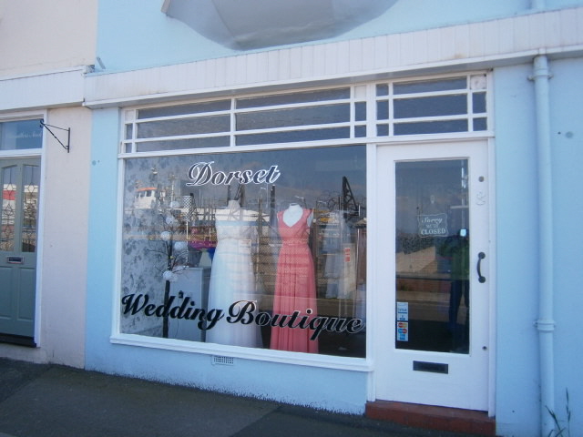
A wedding boutique shop on the site of the old Post Office.
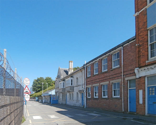
Approaching the entrance of Portland Port.
Return To Top Of Page
THE BEACH [8]
Castletown had for centuries a beach from which fishermen launched their boats into Weymouth Bay. With the building of the breakwater, Castletown became a launching point for boats into Portland Harbour.
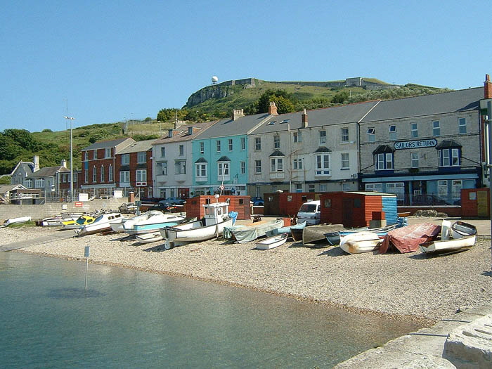
This small area is all that is left. Indeed, casual visitors might miss the existence of Castletown Beach entirely if they drive to the gates of Portland Port, turn around and go elsewhere on Portland as many do.
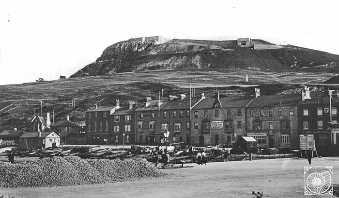
C H Collins and Company Steam Coal Merchant was located to the right of centre of this picture taken in 1910. Note the piles of coal for steaming the ships to the left of picture. A large number of fishing boats can be seen on the beach.
This older picture from 1880 shows the beach on the right with fishing boats. By this time Castletown was perhaps at the height of its industrialization due to the stone trade and the Royal Naval Dockyard.
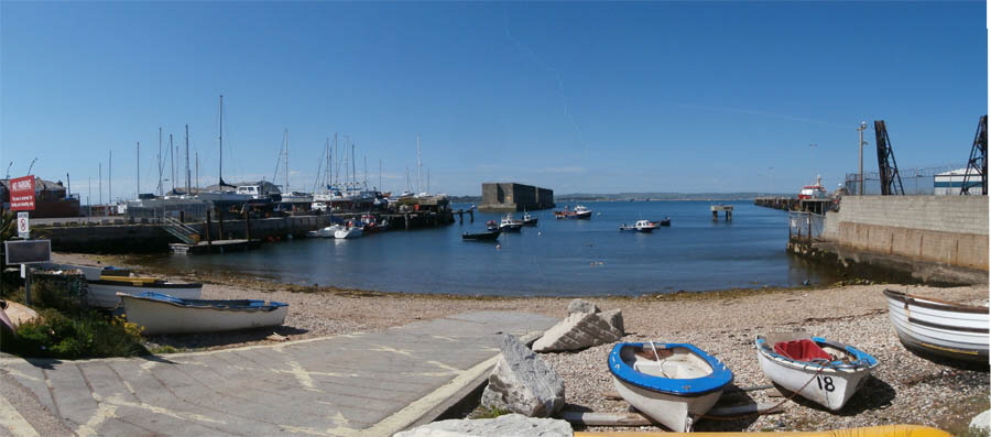
A modern panoramic picture of Castletown Beach
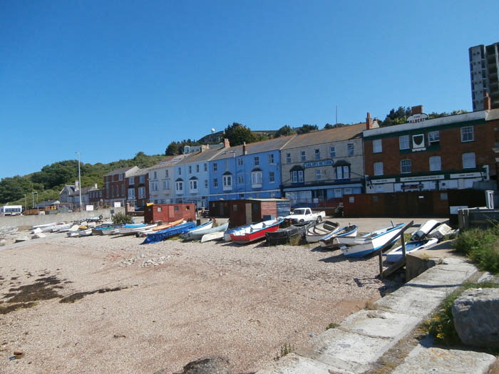
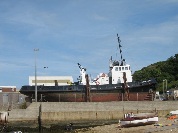
A support ship undergoing maintenance.
Return To Top Of Page
PORTLAND PORT [9]
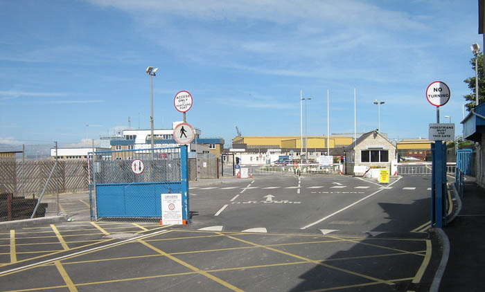
Portland Port Ltd. took over the Royal Naval Dockyard and has built the business up into a thriving operation. The company services and repairs Royal Navy and civilian ships as well as hosting cruise liners.
The company’s website can be seen here.
I have taken no pictures from within the company premises. Indeed, when I stood the entrance gate to take this picture a security guard came running out shouting at me “NO PHOTOGRAPHS!!!” - so I took this shot anyway and strolled away.
Return To Top Of Page
ROYAL NAVAL DOCKYARD [9]
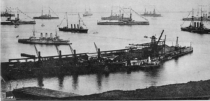
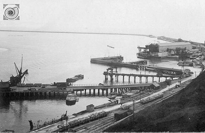
The Royal Navy Dockyard has a long and glorious history right up until its closure in the mid-1990s. It is impossible to cover this huge and important topic here and it is, in any case, thoroughly covered elsewhere. For example, there are many pictures to be seen here of which three are reproduced below.
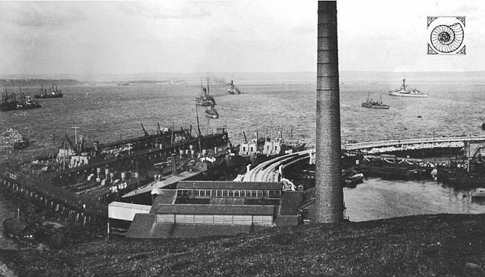
Return To Top Of Page
ROYAL NAVAL SEA PLANES AROUND WORLD WAR 1
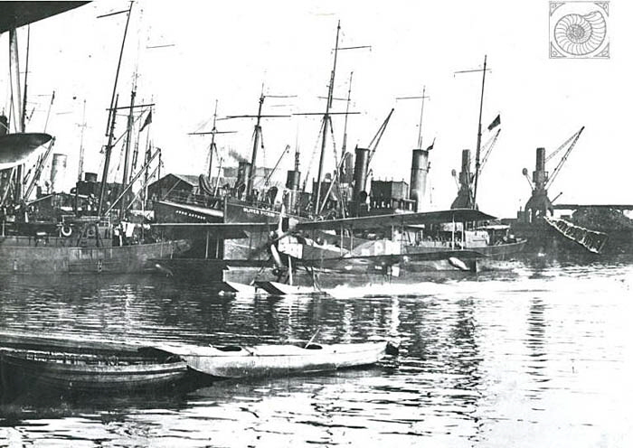
Seaplane (Naval) taxiing at Portland. The vessel in the background is the "Oliver Pickin" found to be listed on the Trawler Index for Grimsby, dated 1916.
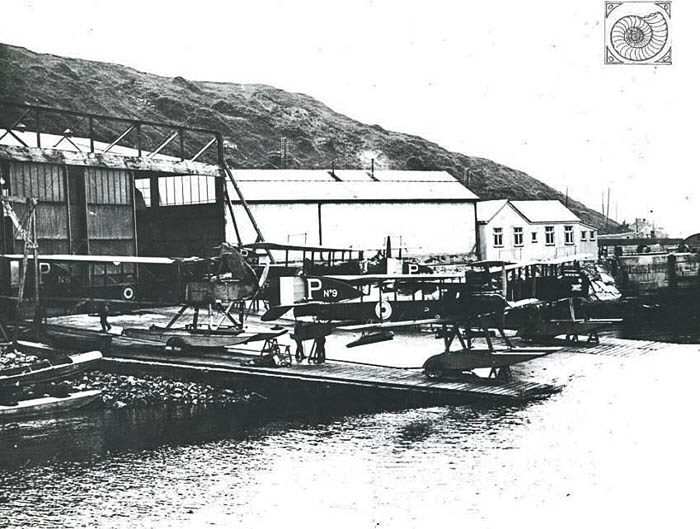
Naval Seaplanes on a launching ramp near Camber Jetty in Dockyard
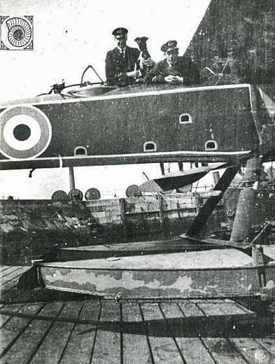
Two Naval Officers (and a dog) posing in a Seaplane at Castletown
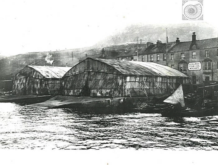
View of two buildings at Castletown ramps. These are believed to be early seaplane hangars
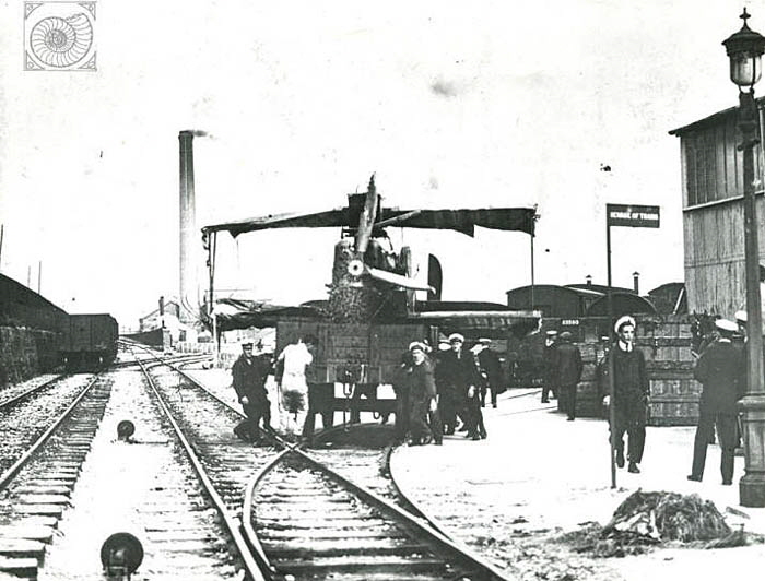
A Seaplane being moved on a railway truck by Royal Naval personnel at Portland taken in the Royal Naval Dockyard looking towards Castletown.
Return To Top Of Page
Keywords Castletown Royal Navy Base Portland Port Royal Breakwater Jolly Sailor Breakwater Hotel Agincare Osprey Leisure Centre Portland Dorset
|