|

Southern Weston
Page and some links last revised/updated 16th July 2025.
|
|
|
© OpenStreetMap contributors - see http://www.openstreetmap.org/copyright
|
|
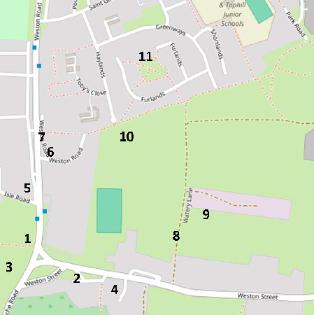
This area covers the main community of Weston. The rather uninspiring housing estate to the west of the main road is covered by the area east of this one.
The area shown on the adjacent map includes the Royal Exchange pub, a finely restored Late Tudor house, several shops, a derelict farm building as well as two football fields.
Please click here for a detailed map. Click the BACK button on your browser to return to this page.
Please click here to visit the satellite image of this area on Google Maps. Click the BACK button on your browser to return to this page.
There are many old pictures of Weston here.
Please click here to see this area on Google Street View.
NB: The former direct links to the Dorset Council mapping service are no longer available due to changes in their website. To see comprehensive options for old mapping coverage of Portland at various dates and scales the NLS website is recommended.
Elsewhere we have seen the animosity between 'Tophillers' and 'Underhillers'. Well, there is animosity between the communities on Tophill. Recently I heard a resident of Easton saying of a resident of Weston who was in trouble with the police
"Well! That's no more than I expect from a Westonite!"
The Weston area became nationally famous in 1979 when a comedy routine by ‘The Goodies’ was partly filmed here - The Royal Exchange pub features in an elaborate and very funny Can Can sequence under the name of “Fred and Ginger’s Cafe" (NB The former link to it on YouTube is no longer valid and the BBC do not have it on their Iplayer. Understood to be Series 1 Episode 5 The Greenies if you wish to seek it via other sources, DVDs etc....)
|
Please use this table to navigate around this page
|
|
WESTON POND AREA [1]
|

|
|
PRIMITIVE METHODIST CHAPEL [2]
|

|
|
DERELICT FARM BUILDINGS [3]
|

|
|
SECOND-HAND WOOD DEALER [4]
|

|
|
A TUDOR HOUSE [5]
|

|
|
GYPSY LANE [6]
|

|
|
DECORATED GARAGE DOOR [6]
|

|
|
SHOPS AND RESTAURANT [7]
|

|
|
WATERY LANE [8]
|

|
|
PORTLAND TOWN FOOTBALL GROUND [9]
|

|
|
ANOTHER FOOTBALL FIELD [10]
|

|
|
HAYLANDS RESIDENTIAL ESTATE [11]
|

|
|
WESTON POND AREA [1]
Weston Pond is seen below. It was opposite the Prince Alfred pub, which closed in March 1973 and was demolished. The pond was by the junction of Weston Road and Weston Street.
Below we see the scene today. The pond was approximately in the middle of the present main road but I was not going to stand in the middle of a busy main road just to get a more accurate picture!
The pond was filled in by 1906 after piped water supply arrived in the area in 1901. The pond was the scene of a tragedy when a small child fell in and was drowned.
Shown below on the west side of Avalanche Road are the culverted remains of a stream that ran to the pond.
In October 2017 there was local consternation when Dorset County Council workmen started digging up the old stones for repair work. However, the work was carried out with sympathy and skill leaving the area improved and the old stonework intact.
The modern buildings where the Prince Alfred pub once stood.
Return To Top Of Page
PRIMITIVE METHODIST CHAPEL [2]
To the left end of the houses shown in the above picture is the Primitive Methodist Chapel. There were a large number of religious sects on Portland in Victorian times with Methodism dominating. In the mid-1980s two Methodist chapels were built in Weston.
Writing in 1979 Eric Ricketts regretted the loss of the original windows. Above we see this chapel in March 2015.
Return To Top Of Page
DERELICT FARM BUILDINGS [3]
To the west of Weston Road are derelict farm buildings. These have been abandoned for as long as I can remember.
Eric Ricketts in his excellent book “The Buildings of Old Portland” describes this as a mid-19th century reconstruction of a much earlier building. The derelict buildings to the right of the farmhouse in this picture date from the 16th century.
In July 2006 the farm buildings were in a very bad state.
This view from 2006 shows the main farm house gutted and looking very sad.
Some precarious stone work in October 2002. These buildings have, from time to time, been surrounded by steel fencing to keep inquisitive explorers out but the fencing is frequently breached.
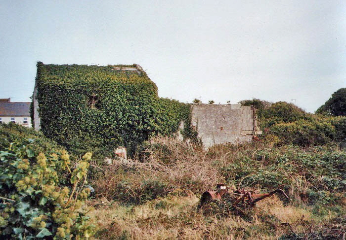
A view recorded in October 2002 from the back showing an abandoned petrol grass cutter in the brambles.
By March 2015 creepers were overwhelming the farmhouse and the rest of the buildings were close to falling down.
The roof of the above building has collapsed in and the entrance has been blocked by steel fencing,
The view into the old barn
Photo pending - the building has now been renovated (Update - 16 July 2025).
Return To Top Of Page
SECOND-HAND WOOD DEALER [4]
Heading off a little further east down Weston Street we see a distinctive house with three arches. Once stables this became a yard selling second-hand wood and I used it a great deal in the 1970s for DIY projects where the quality of the wood was not important. When the dealer sold up the building became a private house but the three arches are a reminder of an interesting past.
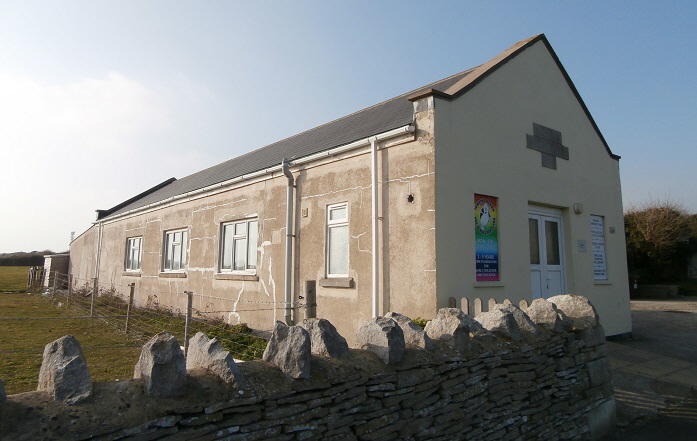
This rather utilitarian building was opened in 1953 and serves a large number of groups active in the Weston area.
Return To Top Of Page
A TUDOR HOUSE [5]
A late Tudor house on the west side of Weston Street (number 72) photographed in 1989 before sympathetic renovation. A terrace of houses was later built on the left which now almost hides this ancient house from view.
Eric Ricketts wrote of this house in his book “The Buildings of Old Portland” that
“This is the best surviving Tudor house on Portland. The east gable has all the hallmarks of Tudor masonry at its best”.
Ricketts puts the date of build around 1600 and writes that this was probably an addition to numbers 68 and 70 which, although earlier builds, have been very much altered over the centuries.
The view of this old house in March 2015 had become restricted by recent near-by buildings and plants as seen below.
Another tiny old cottage with traditional stone slates on the roof stands to the north of the Tudor house.
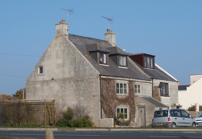
This house is Number 1 Weston Street and stands on the junction near where the pond stood. Eric Ricketts describes it in his book “The Old Buildings of Portland” as an excellent example of the best of Portland building style and skill. It was built in 1740
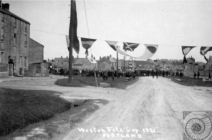
Weston Fete Day 1921 looking south.
Return To Top Of Page
GYPSY LANE [6]
This cottage, along with Portland Museum, are the last thatched cottages left on Portland. It lies in Gypsy Lane which is a cul-de-sac off Weston Road opposite the Royal Exchange pub.
The above and lower pictures were taken in 1990. Little has changed in Gypsy Lane since that date.
This picture shows the same view about a century previously. Next door to the thatched cottage was ‘The Lugger’ pub. It was in this pub that the Court Leet met for many years. The Court Leet was for centuries - and still is - the body of Portlanders who administer and look after issues associated with the land owned by the Crown (Portland being a ‘Royal Manor’) of which there is a considerable area.
“The Lugger” pub was on the site of the more modern building immediately beyond the thatched cottage and the name plate on the nearest cottage proclaims it to be “Enchanted Cottage” - and who would question that delightful name?
Return To Top Of Page
DECORATED GARAGE DOORS [6]
At the end of Gypsy Lane used to be a garage door painted as shown below in this 1989 photograph.
This modern picture shows the door now.
I claim to have started this fashion when I painted my garage door in Radipole Lane in 1974. Many others then appeared throughout Weymouth and Portland. Some other doors are shown below including some of mine from my Weymouth house.
This shows my garage door in 1974 which was very unusual in Weymouth and livened up the neighbourhood.
My next effort is from 1982. Other paintings have included Garfield the Cat and the house now sports elephants painted by my daughter.
This picture was painted on a garage door on the Ladymead Estate near Easton Square. It no longer exists.
This painting existed in Sutton Poyntz but has now been painted over. That pictured below is in Field Barn Drive, Southill.
Return To Top Of Page
WESTON SHOPS AND RESTAURANT [7]
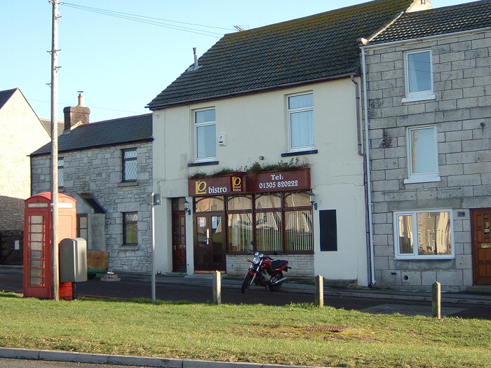
L and O’s Bistro occupied the restaurant where Vaughan’s Bistro operated before they moved to take over The Sea Cow site on Weymouth Harbour side. L and O's closed; however after a period out of use the building has been reopened as a cafe under a new regime (Updated 16 July 2025).
Some small and somewhat specialised shops still survive on Portland although many shops have closed over the past 20 years. Thompson's is almost opposite the Royal Exchange pub and underwent an extension upwards in the summer of 2003.
On the west of the main road is the Royal Exchange pub seen here under going a refurbishment in 2007. To the right is the fish and chip shop now known as “The Codfather”.
The Royal Exchange pub features in a Goodies’ episode where an elaborate and very funny Can Can sequence is danced. The pub appears under the name of “Fred and Ginger’s Cafe”. (NB As also mentioned above the former link to it on YouTube is no longer valid and the BBC do not have it on their Iplayer. Understood to be Series 1 Episode 5 The Greenies if you wish to seek it via other sources, DVDs etc.... Update 16 July 2025)
Return To Top Of Page
WATERY LANE [8]
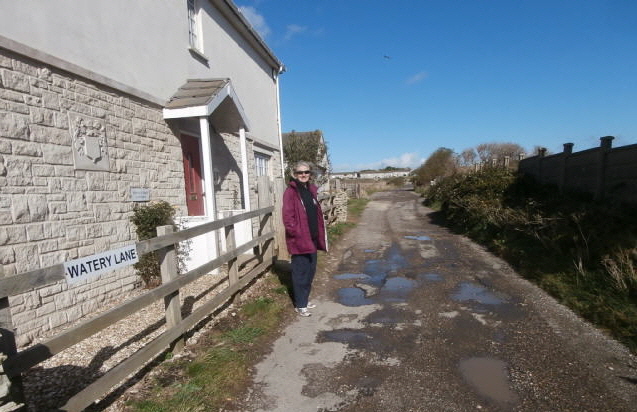
Watery Lane is a track running north from Weston Street to the Haylands Estate. It used to have a small stream running down from a spring but this was hidden in a culvert many years ago.
Watery Lane is the only bridleway on Portland.
This skilfully made weather vane is on a building in Watery Lane.
Return To Top Of Page
PORTLAND TOWN FOOTBALL GROUND [9]
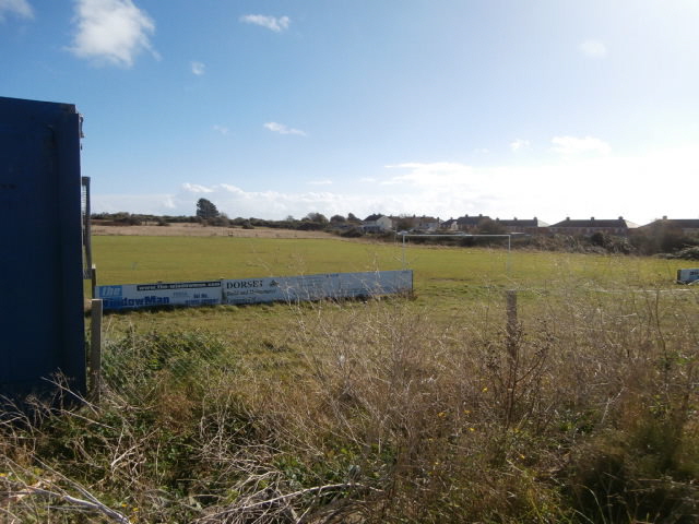
Portland Town football ground in Watery Lane - not to be confused with ‘The Blues Club’ football ground in The Grove.
Return To Top Of Page
ANOTHER FOOTBALL FIELD [10]
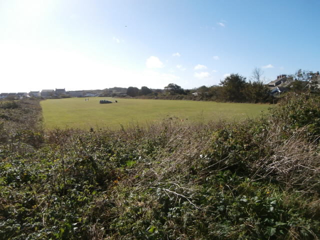
Near Gypsy Lane is a third football pitch.
Return To Top Of Page
HAYLANDS RESIDENTIAL ESTATE [11]
The Haylands Estate is so called because it was built on the wheat fields to the east of Weston (or west of Easton if you prefer!) Building started in the 1960s and many of the houses were built for the Royal Navy.
The whole estate is very bland and I have not been able to work up any enthusiasm for taking pictures there.
If you want to explore this estate without actually going there then click here, sit back and take the Google StreetView tour.
Return To Top Of Page
Keywords Southwell Portland Weston Gypsy Lane Codfather Royal Exchange Prince Alfred public house quarrying Portland Dorset
|