|

Portland Bill
Page and some links last revised/updated 13 August 2025.
|
|
|
© OpenStreetMap contributors - see http://www.openstreetmap.org/copyright
|
|
Portland Bill - world famous because of its picturesque and wild location. The lighthouse is perhaps the most photographed feature on Portland.
Please click here for a detailed map. The arrow points to the centre of the area described here. Click the BACK button on your browser to return to this page.
Please click here to visit the satellite image of this area on Google Maps. Click the BACK button on your browser to return to this page.
Please click here for many historic pictures of Portland Bill and its three lighthouses. Click the BACK button on your browser to return to this page.
Please click here to view the area close up using Google Street View.
There are several good aerial tours of this area produced using drones on YouTube. A typical example can be seen here.
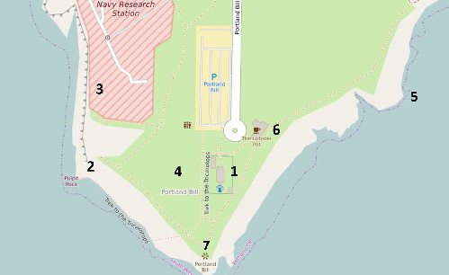
The numbers on the above map refer to items of interest indicated below by numbers thus [1]
|
Please use this table to navigate around this page
|
|
THE ‘NEW’ PORTLAND LIGHTHOUSE [1]
|

|
|
THE LIGHTHOUSE VISITOR CENTRE [1]
|

|
|
THE PULPIT ROCK [2]
|

|
|
THE RAISED BEACH [3]
|

|
|
PORTLAND BILL QUARRIES [4]
|

|
|
THE RED CRANE [5]
|

|
|
CAFES AT PORTLAND BILL [6]
|

|
|
TRINITY HOUSE OBELISK [7]
|

|
|
FOAM ON THE WATER
|

|
|
SOLAR ECLIPSE 1999
|

|
|
Portland Bill is a great place for children to fly a kite.
THE ‘NEW’ PORTLAND BILL LIGHTHOUSE
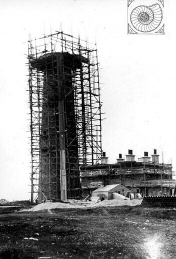 The first proposal to build a lighthouse at Portland Bill was made in 1669 but it wasn't until 29th September 1716 that the first coal-fired lamp shone out from where the upper lighthouse now stands. The first proposal to build a lighthouse at Portland Bill was made in 1669 but it wasn't until 29th September 1716 that the first coal-fired lamp shone out from where the upper lighthouse now stands.
The coal had to be drawn by horse and cart from the ships at Castletown on the furthest northern part of Portland. There was then no track to Portland Bill and in the winter the coal often did not arrive and the fire in the lighthouse went out.
The Trinity House examiners were appalled at this situation and they arranged for the present ‘Higher Lighthouse’ to be built. The lamp was fired using oil; this being the first lighthouse in Britain to be so lit.
In 1789 a second lighthouse was built where the lower - bird observatory - lighthouse now stands.
The main lighthouse on ‘The Bill’ was built and first shone out on 11th January 1906.
Please click here for an excellent article by Ashley Smith describing the history of the ‘new’ lighthouse.
On the left the stars of Orion shine above the ‘new’ Portland Bill Lighthouse in January 1990. The pinkish object in Orion's sword is the Orion Nebula where millions of stars are being created from interstellar gas and dust. I took this picture from the Portland Bill car park at 2 a.m. on a freezing winter's morning. I won a £15 prize with this picture awarded by the magazine ‘Astronomy Now’ in 1990. It was almost worth nearly freezing to death! These days much better pictures combining stars and the lighthouse can be taken with very expensive cameras and a lot of computer fiddling but my picture was taken with a cheap camera which had been accidentally dropped twice onto concrete floors.
On the right the lighthouse appears to be shining but it is only the sun glinting through the optics in this carefully positioned picture.
Two more unusual pictures of the ‘new’ lighthouse. On the left Portland Bill Lighthouse is swathed in scaffolding and polythene undergoing a facelift, 1990. On the right we see the moon rising early one winter’s morning.
On the left this old lamp holder from Portland Bill lighthouse can be seen in the Portland Museum close by Pennsylvania Castle in Wakeham. The ship in the old picture on the right has probably been superimposed for artistic effect.
Return To Top Of Page
LIGHTHOUSE VISITOR CENTRE
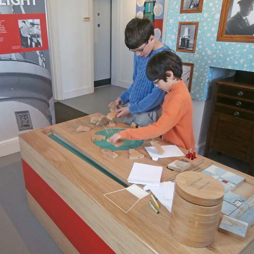
The newly refurbished Lighthouse Visitor Centre was opened in April 2015. The website can be visited here.
There is a small but interesting display of historical equipment and history. This is followed by an escorted climb to the lantern to see the lamp and rotating lens.
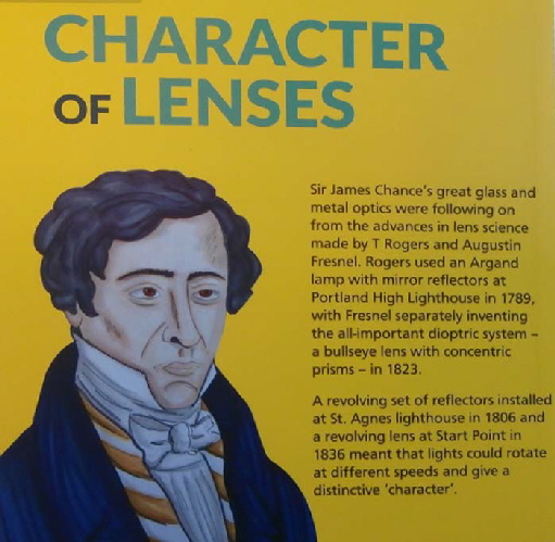
The auxiliary power supply. Electricity was not bought to Portland until the 1930s. The reason for this very late arrival was because Portland Town Council owned the gas works in Chiswell and did not want the ‘newfangled’ electricity to undermine the profitability of their gas supply.
Visitors to Portland in the early 1930s must have been amazed to find themselves transported back to Victorian style gas lit houses and streets.
Because of this anachronism the lighthouse was lit by oil until mains electricity arrived at Portland Bill just a year before the outbreak of World War 2.
The emergency battery stack.
The clockwork counterweight that was used to rotate the lamp before the arrival of mains electricity in 1938. The weight had to to hand winched every 75 minutes day and night. Failure to keep the clockwork working was a sackable offence.
Above we see examples of the two types of lamp used since 1942. The lens assembly weighs 3.5 tonnes and is floating on 0.75 tonnes of Mercury. It revolved three times each minute. The light can be seen to a distance of 25 miles.
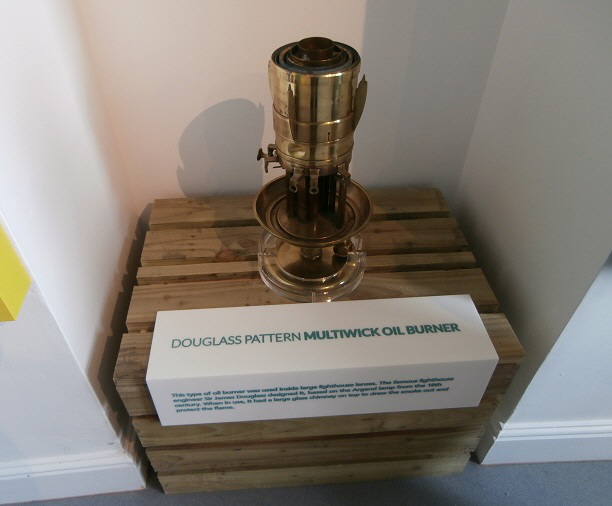
The main bulb and a spare ready to be switched into place. Below is an example of the oil lamp used until the late 1930s when electricity eventually arrived at Portland Bill.
Return To Top Of Page
THE PULPIT ROCK
The Pulpit Rock is a rock stack which was once much larger and contained ‘White Hole’ arch. This was quarried away to leave the present stack and the leaning slab was placed in position - possibly in the 1870s.
Picture kindly supplied by Stuart Morris
This rare and undated drawing shows the rock stack and arch before the right-hand side was quarried away.
It was intended to have the appearance of a bible opened and leaning on a pulpit. In the 19th century many Portlanders were fiercely religious and followed a variety of sects; many having sprung from a visit by John Wesley.
By the turn of the 20th century churches and meeting halls - such as the ‘Ranters’ Lodge’ on Chesil - housed worshippers of many generally non-conformist groups such as Wesleyan Methodist Church, Primitive Methodist Church, Congregational Church, Bible Christian Connexion, Salvation Army, Zionists, The Brethren as well as the conformist and Catholic religious groups.
The picture below shows a group of worthy Portlanders who attended the Zion Chapel in Weston around 1900. Beards were very much a status symbol in those far off days!
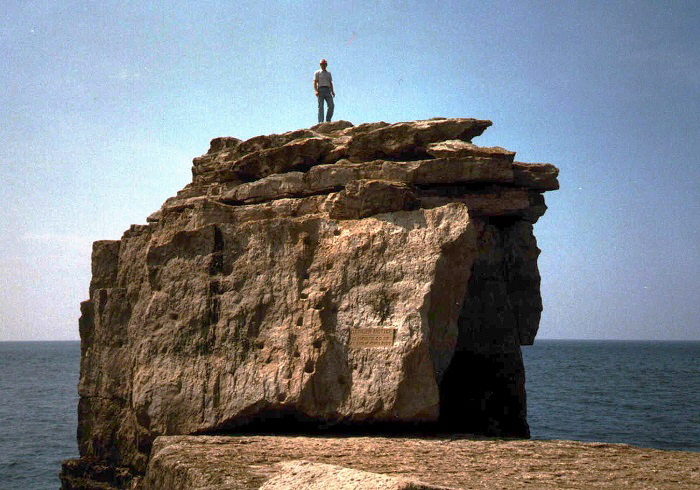
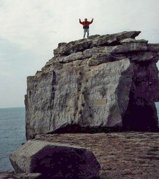
WARNING! NEVER CLIMB ON THE PULPIT ROCK!
OK! So that’s me in the late 1980s but I was young and foolish in those days. Do what I say - not what I do!
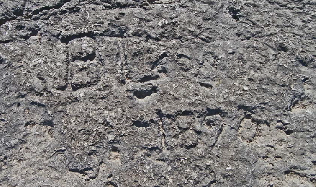
In the rock near the Pulpit someone has carved their name. The graffiti reads "B Low 1890" - Victorian graffiti has a rarity and interest value that modern graffiti will not acquire.
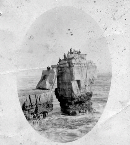
People climbed on Pulpit Rock even in Victorian times!
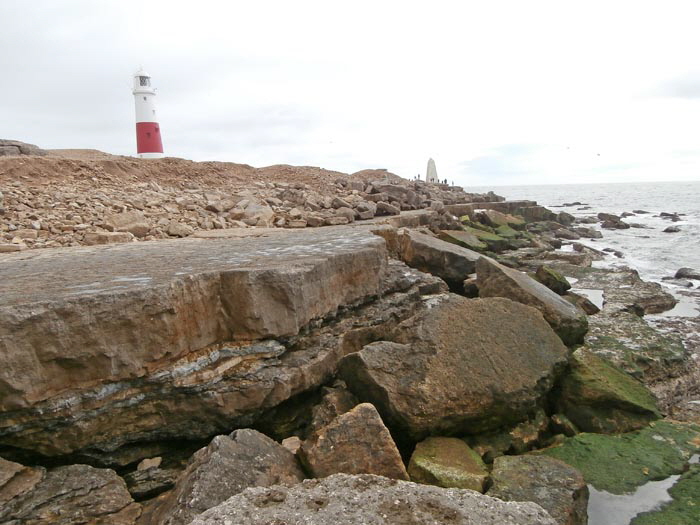
During the violent storms of January 2014 the stone ledges near to Pulpit Rock were undermined and the shelving broke away. This picture from April 2015 shows how the ledges collapsed. In this way Portland’s coastline is gradually being eroded away.
Return To Top Of Page
PORTLAND’S SOUTHERN RAISED BEACH
The Ministry of Defence magnetic test range at Portland Bill and, in the foreground, the famous 'Portland Raised Beach'.
This latter was created during a warm inter-glacial climate change about 200,000 years ago when sea levels were about 15 metres above present levels. Above the fossil beach is a thick layer of wind-blown sand capped with limestone rubble deposited during the Arctic conditions of the last Ice Age. Further details of this raised beach may be found here. There is also an excellent accessible guide to the Raised Beach and the geology of the Portland Bill area here.
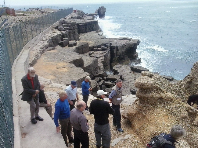
The pictures above and below shows a Dorchester U3A Geology group visit to the Raised Beach in 2015 - please click here for details of this group.
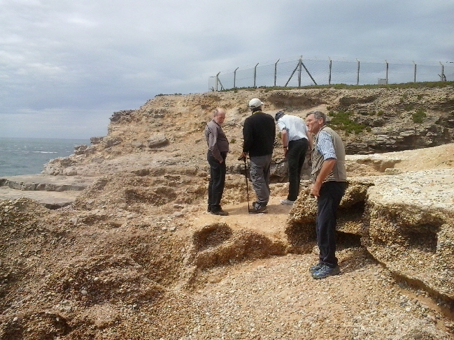
Return To Top Of Page
QUARRYING AT PORTLAND BILL
The whole of Portland Bill has been shaped by quarrying. The two pictures below show the quarrying activity in the 1930s and the effect on the present landscape.
The following pictures show quarrying activity in the early 1900s.
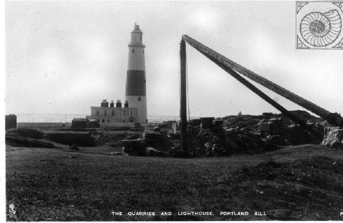
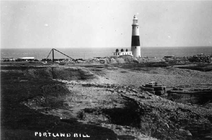
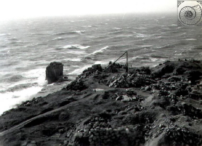
Before the ‘new’ lighthouse was built in 1906 there were tramways running over the area of Portland Bill. Victorian maps show a tramway which ran to the ‘Red Crane’. Traces of this tramway can still be seen.
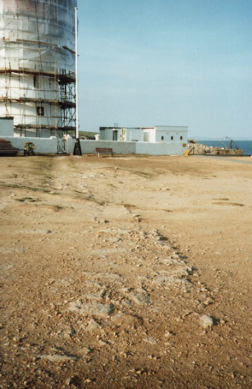
Stone blocks were used to support the tramway rails and these are still visible. They run from south of the lighthouse and go under the buildings to emerge near to the Lobster Pot Cafe. The track then ran in a gulley until it reached the cliff edge and the crane.
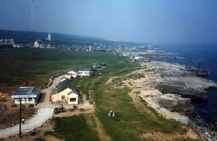
The tramway ran to the right of the cafe and beach huts to the Red Crane. Compare the above and lower pictures which are separated by twenty-five years. It can be seen that a lot of small buildings and a cafe have be gone as a result of a ‘clear up’ exercise a decade or so ago.
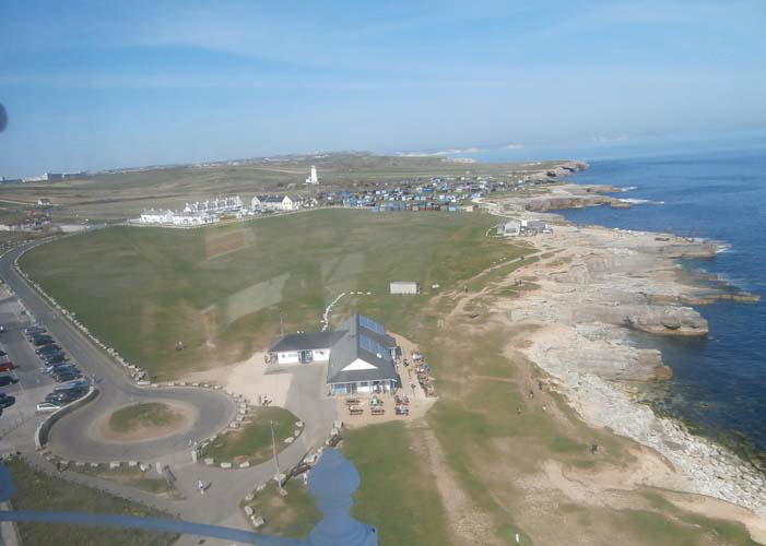
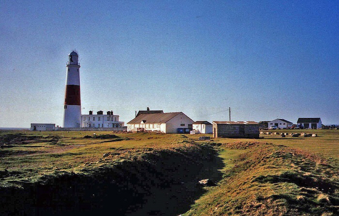
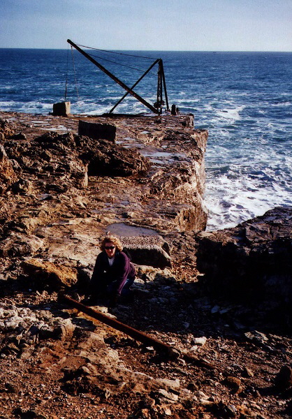
These tramway rails were exposed by a storm in the 1990s.
Return To Top Of Page
THE “RED CRANE”
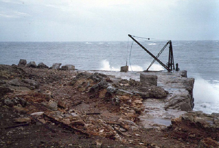
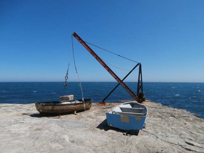
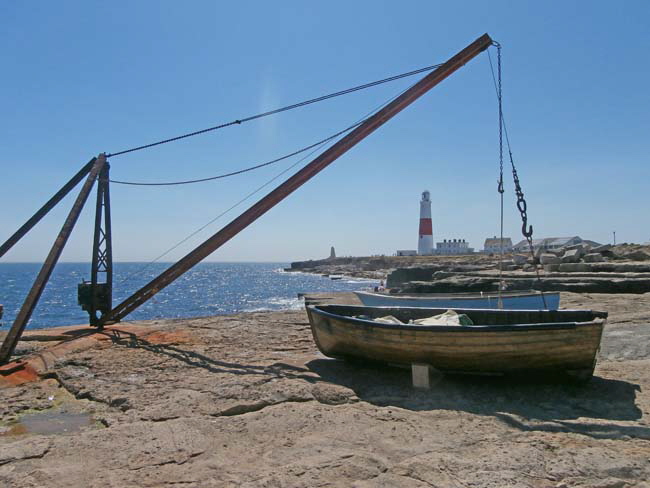
The ‘Red Crane’ in the early 1980s.
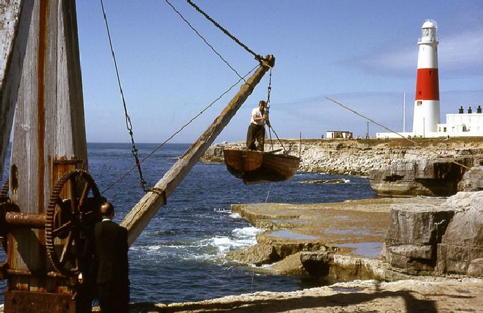
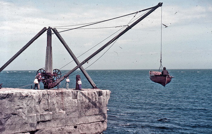
The above excellent photograph was taken in 1966 and is copyright John Wray and licensed for reuse under this Creative Commons Licence.
In those days it was used to haul fishermen’s boats into and out of the water. A few years after I took this picture the crane was destroyed by a vandal with a chainsaw after a local dispute. It was replaced by a metal crane.
Vandalism is a popular pastime on Portland. One of many other Portland features that have drawn the attention of gangs of vandals and arsonists has been Lano’s Bridge in Tout Quarry which was attacked with heavy equipment with the intention of completely destroying it.
Portland vandalism is not just about Graffiti and throwing stones through windows - although that happens on Portland as anywhere. On Portland vandals go out equipped with crowbars, chainsaws, sledgehammers and fire raising material to cause destruction on an industrial scale.
Please click here to see a really excellent picture of the crane in action. Return here using your browser BACK button.
Return To Top Of Page
CAFES AT PORTLAND BILL
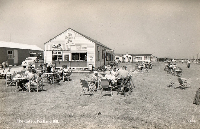
This old picture is shown by kind permission of Peter Siddons,
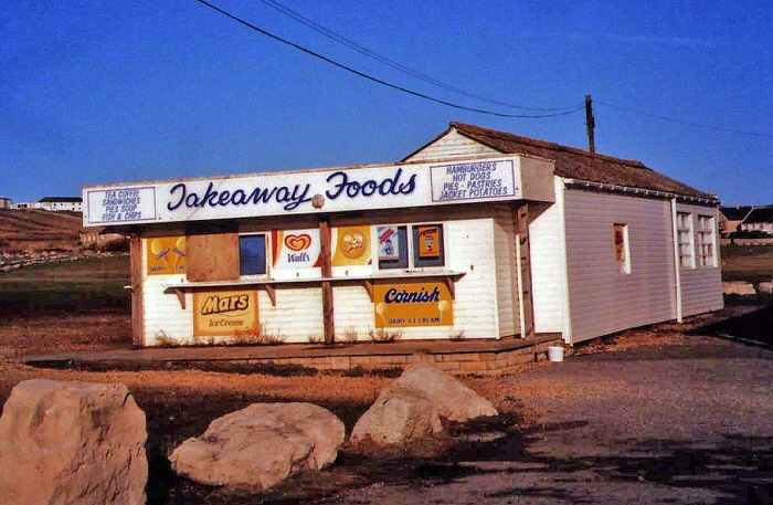
The Cosy Cafe photographed in the early 1990s
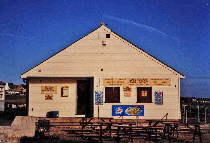
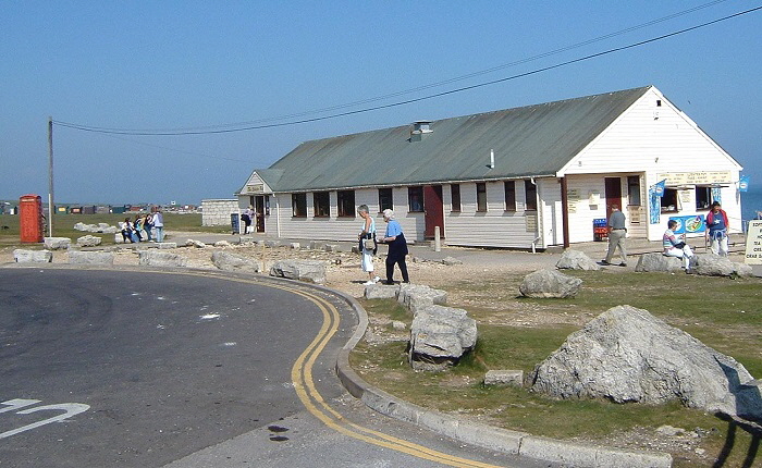
The Lobster Pot Restaurant photographed in the early 1990s
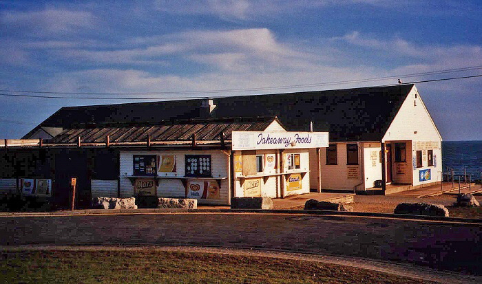
In October 2002 a planning application was submitted to demolish "The Cosy Cafe" - for long a familiar landmark at Portland Bill. By April 2003 it was gone leaving just the “Lobster Pot Restaurant” whose website is here.
Return To Top Of Page
TRINITY HOUSE OBELISK
At the southernmost point of Portland stands the Trinity House Obelisk. The letters ‘TH’ suggest - wrongly - to some visitors that this is a monument to Thomas Hardy the Dorset-based author or Thomas Hardy who was a Captain at the Battle of Trafalgar - of “Kiss me Hardy” fame. However, the 7 metre obelisk was erected in 1844 as an important marker for sailors passing around Portland Bill. In 1905 the present very more prominent red and white lighthouse was erected close by and the need for the obelisk declined. In September 1978 it was given Grade II listed status.
Ashley Smith notes (please click here for details) that the obelisk is featured on the album cover of Nik Kershaw’s 1984 “The Riddle”.
By 2002 it was in a perilous situation because the sea was eroding the surrounding rock and foundations. Trinity House announced that it intended to demolish the obelisk but a vigorous campaign by people who wanted the obelisk saved has resulted in the landmark still standing in 2018.
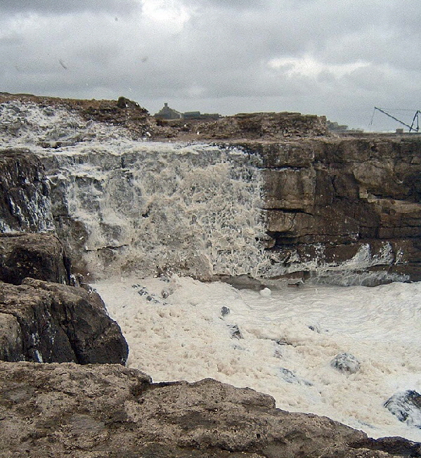
FOAM ON THE WATER
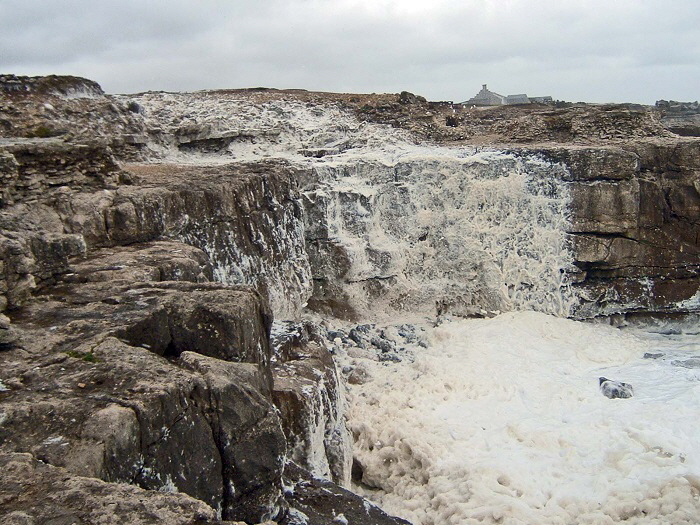
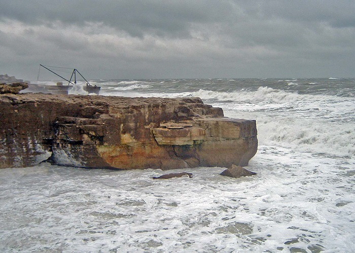
This looks like a terrible outbreak of pollution but it was a rare but natural phenomenon.
Return To Top Of Page
ECLIPSE OF THE SUN, 11th AUGUST 1999
There was a total eclipse of the Sun in the South-West of England on this day; an event I had been eagerly awaiting since I was a small child. I first saw a prediction of this event in about 1950. It seemed (and really was) a lifetime away and I really hoped I would live long enough to see it.
The southernmost point in Dorset - Portland Bill - the northern limit of totality for the eclipse was predicted to pass just one kilometre south of Portland Bill but that was out at sea.
The weather forecast was bad and did not improve as ‘Eclipse Day’ approached. I opted to stay in Dorset.
My partner and I cycled the 18 kilometres to Portland Bill from our house. Even if the eclipse was not total, being less that 1,000 metres from the northern limit meant that the sky would get spectacularly dark and it might even be possible to see the ‘Bailey’s Beads’ phenomenon as the limb of the Sun passed along the mountains and valleys of the Moon’s limb. Indeed, some observers deliberately place themselves in this very narrow zone where the limb of the Sun flickers down the valleys on the Moon’s limb.
Through the clouds we got glimpses of the crescent Sun - that was when it really got exciting! The eclipse I had been waiting for over six decades to see was underway!
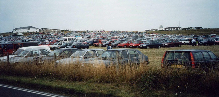
Cars were jammed all over Portland; their drivers desperate to get as far south as possible. By the time my partner and I arrived at the southern tip of Portland every field was full of cars - never previously had local farmers had such a financial bonanza! These fields were normally deserted and barren.
By the time we and two friends arrived it was getting significantly dark. As the time of the eclipse approached the cloud was continuous. There is a very atmospheric photograph of this time here.
However, we saw a dark patch on the horizon in the west which was moving towards us. It got larger, the surroundings quickly dimmed to almost perfect darkness and the huge black stain on the clouds moved quickly past us to the south. It was then so dark that only the immediate ground about us could be seen and the beams of Portland Bill lighthouse shone out. Cheering broke out despite the obscuration of the clouds and a large group of Hell’s Angels revved up their bikes to show their appreciation of this spectacle.
The picture above was taken by me at the mid-eclipse showing how dark the scenery became despite not quite being in the track of totality. The light to the left is the lantern of Portland Bill lighthouse.
Return To Top Of Page |